CEDAR CITY — Cedar City Council voted unanimously to approve the newest natural hazard mitigation plan on Wednesday, making the city eligible for pre-disaster grant funds.

Cedar City staff and council members first discussed adopting the Five County Association of Governments’ Multi-Jurisdictional Natural Hazard Mitigation Plan for 2022-2027 during the Sept. 28 council meeting.
City manager Paul Bittmenn said that approving the plan is required by the Federal Emergency Management Agency in order to qualify for FEMA reimbursements, grants or other available funds.
The Five County Association of Governments developed the Natural Hazard Mitigation Plan, which was approved in June by the State of Utah Department of Emergency Management and FEMA, according to the Natural Hazard Mitigation Plan’s website.
As communities like Cedar City approve the plan by resolution, they will receive approval from FEMA and become eligible for pre-disaster mitigation grant funding, the site states.
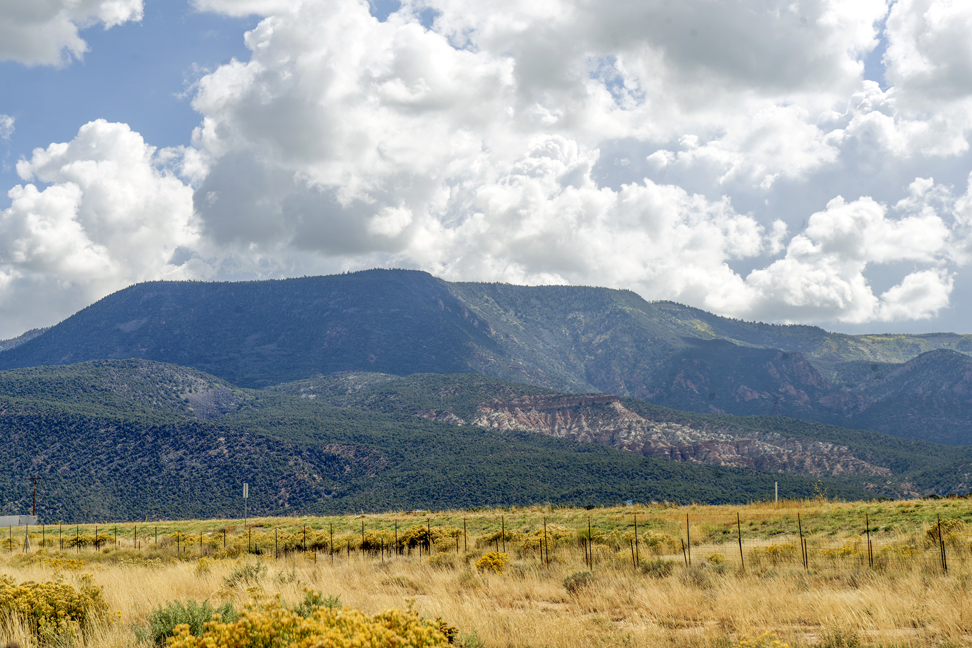
The Southwest’s residents and visitors have frequently experienced natural hazards that “pose significant impacts to the population and infrastructure,” the mitigation plan states.
“Since 2006, the Five County Association of Governments has developed a Natural Hazard Mitigation Plan, intended to equip the region with an action plan to preserve the built environment, populations, industry and natural world that make Southwestern Utah a vibrant place to live and recreate,” the document states.

The 1,349-page document includes mitigation plans for Beaver, Garfield, Iron, Kane and Washington counties and the Paiute Indian Tribe of Utah.
The portion of the plan that was approved by the council includes information about natural hazards that occur within the Cedar City area and a history of hazard events. Additionally, it lists suggestions for keeping the community safe that were developed in collaboration with the city, Bittmenn said.
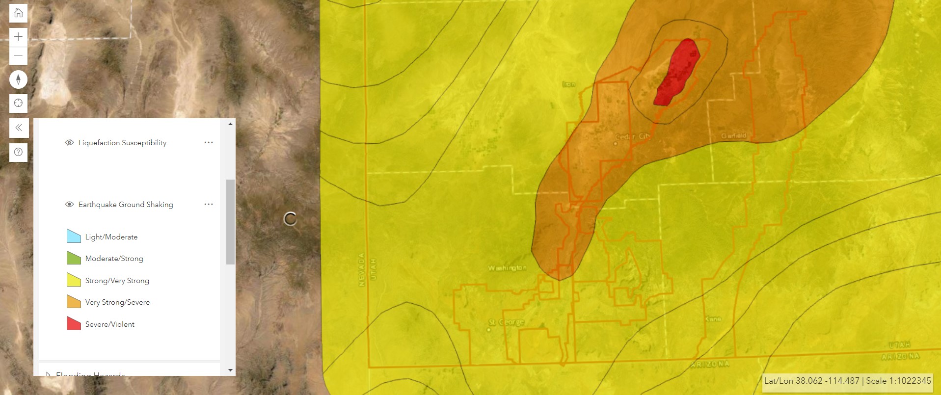
Council member R. Scott Phillips expressed surprise that the risk of earthquakes was rated high while drought was moderate and asked if the group had looked over past data to come to those conclusions.
Bittmenn said people may need to take “a little wider few of our world.”
“For me, drought would be the worst right now,” he said. “Right? Because we’re in a big drought. But historically, we kind of go into drought cycles, and some years we have too much water and there’s no drought issues.”
Cedar City Mayor Garth Green said he thought the association likely took the Hurricane Fault, which extends from south of the Grand Canyon to Cedar City, into consideration.
“That’s an inherent danger that — we don’t always feel it,” he said.
Last month, people in Southern Utah did feel a magnitude 4.4 earthquake on the Hurricane Fault.
The fault is capable of generating up to 7.0 magnitude earthquakes, which can cause significant damage, St. George News reported previously.
No quake of a magnitude 4.2 or higher has been recorded in Cedar City since 1942’s magnitude 4.8 earthquake, according to the plan.
There are two medical facilities, an assisted living facility, two schools and some residential properties within one-quarter mile of a fault.
Additionally, Interstate 15 and several city roads run across fault lines, especially in Cedar City’s Cross Hollow area, according to the mitigation plan.
The age and construction types of buildings are also factors that contribute to earthquake risk. Unreinforced historical structures, like those found throughout the city, were constructed before Utah started seismic building codes in 1975 that required reinforcing.
“This construction type can topple during shaking and damage property and people in and outside of the structure,” the plan states.
The plan presents four mitigation strategies to increase earthquake safety. For instance, the city plans to reduce the hazard caused by large furniture and equipment in public buildings by implementing “nonstructural retrofitting techniques” in city structures to prevent damage or injury in a shaking event.
Cedar City’s groundwater and agricultural lands are at risk due to drought and the area is at an “increasing risk of other natural hazards from drought events,” according to the plan.
When surface water is lost through evaporation before it can be absorbed into the ground, the city’s aquifer may see less recharge, which could increase the potential for poor water quality, the plan states.
Agricultural lands could be the first to feel the impact of dry conditions, causing economic challenges due to damaged crops or livestock.
Additionally, drought can increase the risk of other natural hazards, like wildfire and landslides, the document states.

There are also four drought mitigation strategies included in the plan, including protecting the city’s groundwater aquifer by working with the Central Iron County Water Conservancy District to study and mitigate issues stemming from groundwater overuse. And, conserving water at public facilities by incorporating drought-tolerant landscaping at city-owned buildings.
In some cases, the city is already enacting mitigation strategies. For instance, Bittmenn said that the Cedar City Fire Department works to reduce fuel loads each summer to limit wildfire risk.
Various departments will be responsible for implementing mitigation plans and may go to City Council to fund programs, Bittmenn said.
“We’ll have to work collaboratively within the city structure to try to meet some of these goals,” he said.
According to the plan, the natural hazards Cedar City is at high risk for are:
- Wildfires
- Floods
- Earthquakes
Cedar City is at moderate risk for:
- Severe weather
- Drought
And it is at low risk for:
- Landslides
- Radon
- Problem soils
To learn more about Cedar City’s hazard mitigation plan, it can be viewed here, starting on page 422.
Copyright St. George News, SaintGeorgeUtah.com LLC, 2022, all rights reserved.