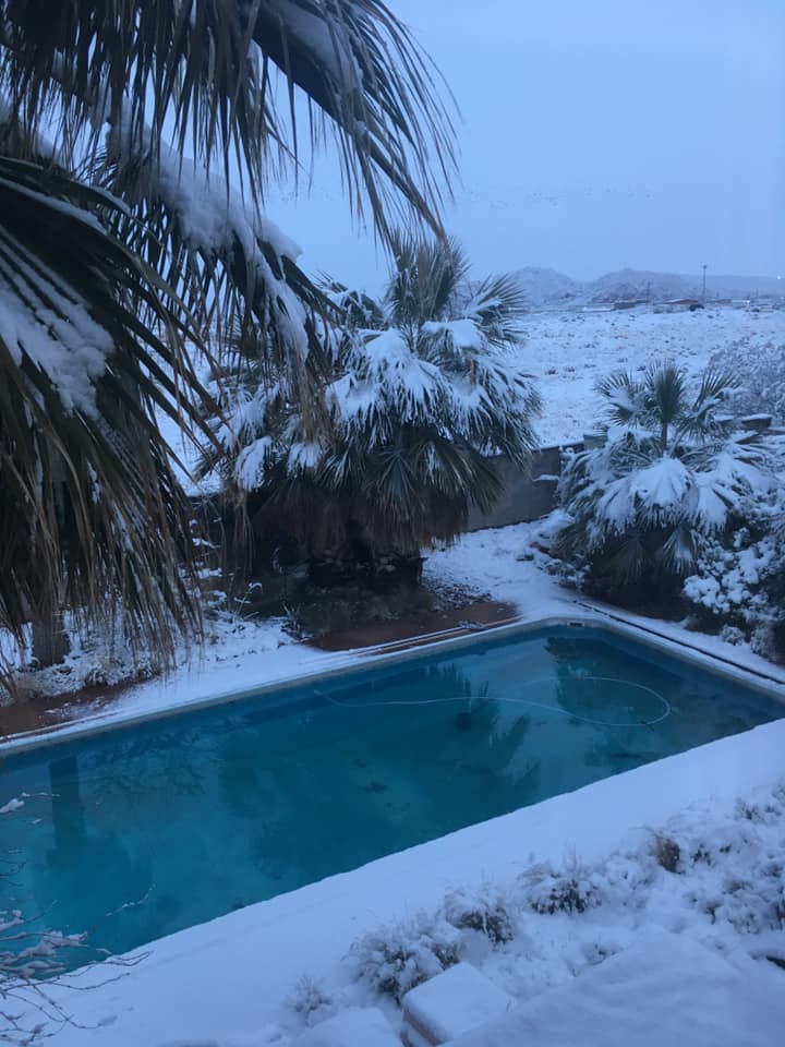
ST. GEORGE — If the forecast from the National Weather Service is correct, there is going to be a dusting of white throughout the St. George area on Monday, and a much heavier tempest further north that will cause hazardous traffic conditions.
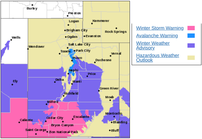
The National Weather Service has issued a winter weather warning for much of Southern Utah, meaning a heavy snowstorm is imminent. The warning – for all of Washinton County and parts of Iron, Kane, Garfield and Beaver counties goes into effect starting at 5 a.m., Monday and continues through 11 a.m. Tuesday.
Heavy snow is expected with areas of blowing snow with snow accumulations of 10 to 20 inches and the possibility of up to three feet of snow in the mountains, the National Weather Service said.
The National Weather Service said there is a 50% chance of snow in St. George at 2 a.m. Monday, becoming a 100% chance by sunrise. The forecast says 2 to 4 inches of snow are expected in the St. George area.
The last substantial snowfall in St. George was on Feb. 21, 2019.
Further north, very heavy snowfall is expected over mountain routes, particularly during the day Monday through Monday evening, with snowfall rates of 1 to 2 inches per hour in some locations.
In Cedar City, it is possible for the wind chill to make the temperature feel like it is zero. By the end of Monday, 5 to 11 inches of snow may accumulate.
In Panguitch, 1 to 3 inches of snow is possible with a wind chill of -9, 5 to 11 inches of snow possible in Kanab and 1 to 3 inches of snow in Beaver County.
Especially north of St. George, travel could be very difficult to impossible. Areas of blowing snow will result in drifting snow and poor visibilities at times.
The areas where the storm could be at their worst for driving conditions includes northern Zion National Park and Kolob Canyon, Bryce Canyon, and state Route 14 between Cedar City and Long Valley Junction.
Copyright St. George News, SaintGeorgeUtah.com LLC, 2021, all rights reserved.