LETTERS TO THE EDITOR — With the public comment period for the Northern Corridor environmental impact statement fast approaching, St. George News has received many letters offering thoughts on the proposed highway. Included in this article are six opinion pieces on the subject offering varying viewpoints on the matter ahead of Thursday’s public comment deadline.
Northern Corridor deception
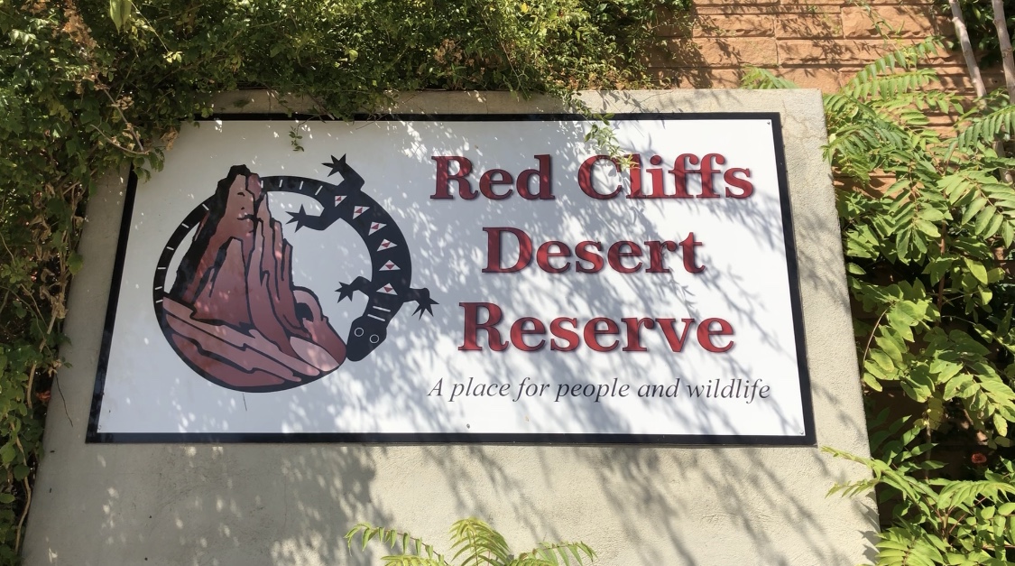
On May 30, 2019, I awoke to a mixture of sunrise and thunderheads in the eco-similar community of “The Cliffs” in northern St. George, excited by the prospect of spending the day in the Red Cliffs Desert Reserve and Zone 6 lands, as described below. As a Council member of the Desert Tortoise Council, I’ve written several comment letters on the Northern Corridor, had one article published in the Spectrum, and traveled to Washington D.C. in September 2018 to meet with five Congressmen and three Senators (mostly with their staffs) to talk about the science of constructing a freeway through a tortoise Reserve, namely the “Red Cliffs Desert Reserve,” which portends the detriment of tortoises within that Reserve.
Herein, I’m still speaking as a 30-year veteran of walking the desert looking for tortoises (witnessing the detrimental aftermath of road development) and a 60-year old man offended by a deception, but I’m NOT representing the Desert Tortoise Council and am talking more about social issues than science. I coin the phrase “eco-similar” above in reference to the myriad communities within St. George particularly along its borders where from a distance, single-story homes often resemble rocks and cliffs. That morning, through my adobe window, I saw house finches and hummingbirds flitting about the bright green xeriscaping juxtaposed to the cliff-colored home of my host.
I’d last been in St. George in 1992 as an Eagle Scout and then-Assistant Scout Master with a Latter Day Saints church in Wrightwood, California. At that time, I had left my daughter with an LDS family I was meeting for the first time, trusting strangers with our precious cargo, so we could lead a dozen young Scouts through nearby Zion Narrows. Given the passage of 28 years and the immensity of development in the interim, the city has become almost unrecognizable except for iconic features such as the centrally-located Tabernacle and the naturally iconic red cliffs to the north.
I was invited to attend the May 30th trip as an expert on desert tortoises and author of four of the first ten Habitat Conservation Plans (HCPs) for the species in California, including the 1st, 2nd, 4th and 7th HCPs that resulted in 10(a)(1)(B) incidental take permits. As such, I understand the intricacies of the Washington County HCP and subsequent incidental take of tortoises throughout the county. I was also the primary BLM biologist formulating the tortoise conservation strategy for the West Mojave Plan in California from 1998 to 2004. So, I understand the formula comprised of consensus building, public trust, and the fragile balance of immediate development in exchange for promised conservation. And, I understand the current intent and threat to manipulate the formula to develop the Northern Corridor through the Reserve by premeditating mitigation for a violation that has yet to occur but is being rigorously planned for as I write this.
If you are living in a house built since 1996, you are living there as a result of an agreement among numerous agencies and entities that has already resulted in the development of thousands of acres of tortoise critical habitat and many thousands of acres of both incorporated and unincorporated lands within Washington County in exchange for protecting, through a conservation agreement, the 60,000-plus-acre Red Cliffs Desert Reserve. This development is irreversible, but the commitment to conservation is now being threatened by planners and politicians (herein “them” and “they”) who were not part of the consensus-building process that resulted in the formula of “development now in exchange for conservation later.” What the Draft EIS unfortunately calls “A deal is a deal” (for humans, yes, but not the tortoise!).
The Draft EIS explains in scientific jargon that a 6,760-acre combination of lands in the nearby Red Bluffs Area of Critical Environmental Concern (ACEC) and Utah School and Institutional Trust Lands Administration (SITLA) referred to as “Zone 6” will adequately mitigate the construction of the freeway through the Reserve. However, the Draft EIS does not divulge that the ACEC is being cut in half – ecologically compromised – in anticipation of building a “Western Corridor” through the middle of the ACEC sometime in the future, effectively bisecting this essential tortoise habitat like the Northern Corridor would the existing Reserve. Apparently, having seen how difficult it is to construct a freeway through the existing Reserve, they are discretely planning for a future freeway that will cut-in-half an existing conservation area to accommodate a future freeway.
They may (or may not) rename Zone 6 “Red Cliffs Desert Reserve (Junior)” and tell you that the loss of 150 acres (or 200, or 240, depending on which of the three acreages is correct in the Draft EIS) of tortoise habitat to construction of the Northern Corridor within the actual, existing Red Cliffs Desert Reserve is an acceptable loss compared to the acquisition and new management of these 6,760 acres of tortoise habitat within the non-contiguous satellite reserve. Although they reveal that Washington County has seven million dollars in collected mitigation fees, it is less clear that none of this money will be used to acquire the SITLA lands, or that the BLM is already required to manage the ACEC (ALL of it, NOT just the eastern half) for tortoise conservation.
They are claiming in the Draft EIS that managing 6,760 acres in exchange for losing 200 acres is a good deal, but please understand that the existing 60,000-acre Reserve is tens of thousands of acres smaller than the minimum reserve area identified in the Recovery Plan for recovery of the desert tortoise. Bean counters may tell you that the 60,000-acre Reserve (the “red bean”) plus the 6,760-acre Satellite Reserve (the “lima bean”) will comprise a fine recipe for tortoise conservation, but who wants lima beans in their chili or dead tortoises in our conservation area?
Planners and politicians are telling us that the four-mile freeway could be reconfigured so that it now bows through the Reserve to the south (like a UDOT smile) rather than to the north (like a crooked T-Bone smile), and that this reconfiguration is somehow less impacting even though both are about four miles long and both bisect the Reserve, fragmenting some of the densest tortoise populations within the Reserve. They want to justify the freeway by telling us that there are more tortoises per square kilometer within both the Reserve and Zone 6 than anywhere else in the listed range (17-20/km2 compared to fewer than 6/km2 in most Recovery Units) and they erroneously tell us that tortoise populations have stabilized within the Reserve after the devastating wildfires of 2005, 2006, and now in 2020. (This is emphasized in the Draft EIS in spite of a 5 tortoise/km2 decline between 2017 and 2019, and an overall 41% decline in tortoise numbers within the Reserve since 1995.) In telling us this, they imply that the population can afford to be fragmented by the Northern Corridor.
They are telling us that Utah Department of Transportation cannot function properly unless the freeway is constructed. In so doing, they suggest that the Northern Corridor must be constructed for these and numerous other entities to function properly. Planners and politicians are telling us that the HCP can no longer function and will not be reauthorized without the Northern Corridor.
In so doing, they fail to divulge that conservation of the existing HCP is compromised because the Northern Corridor was not part of the 1996 agreement, claiming that reauthorization cannot occur without the freeway, which is not true. Technically, all they need to do is extend the functioning date of the incidental take permit, which expired four years ago. That, and identify new ways to deal with unleashed pets, tortoise poaching, predation by ravens, wildfire, and non-native weeds in the Reserve, which are the real issues not being adequately addressed by the 1996 HCP or in its 2020 revision.
Spending May 30th, in the Reserve for my first time, was enlightening. As we visited Zone 6 near the end of the day, our conversation was interrupted by automatic gunfire occurring several hundred yards north of us, a harbinger of what the County will face in trying to curtail existing uses that are not compatible with tortoise conservation.
They briefly mention that they plan to continue uses such as a state-wide championship mountain bike race inside the satellite reserve and call this use “compatible.” The Draft EIS fails to divulge that successfully curtailing illegal activities like target-shooting and cross-country vehicle travel in Zone 6, will predictably displaced these activities to the west, onto other ACEC lands that are supposed to be aggressively managed for tortoise conservation.
Tortoises that once occupied all of southern and eastern Washington County are now being relegated to residual reserves. Now that the reservations are established and associated agreements codified, new politicians and new planners are willing to develop the Reserve and rewrite those agreements (which likely sounds like history repeating itself to our Native American brothers). Development of the Northern Corridor would be history repeating itself, this time with a new victim: The once-common, now-imperiled desert tortoise.
Manipulation and deception are alive and unwell, except this time the victim – the tortoise – has no voice of its own. The people of St. George who occupy beautiful southwestern-style homes in cozy communities need to know that their human habitats are possible because there was an agreement in 1996 that promised secure tortoise habitats, which are now being threatened and agreements about to be violated, in exchange for building those homes. To say that tortoises living in the Reserve are being benefitted by conservation in Zone 6 is like saying that residents in St. George are better off because residents of Ivins are being treated equally. I trust that conscientious residents of St. George will understand that they are living comfortably in homes that were secured by the perceived promise of conservation of tortoises within the Red Cliffs Desert Reserve, which is now being threatened by planners and politicians.
Submitted by ED LARUE, Southern Utah.
Northern Corridor would diminish home values, lifestyle and health
We are writing this letter in response to Washington County’s request for the Northern Corridor Highway. We have multiple concerns regarding this request. This request doesn’t directly affect those making the request, but does directly affect our lives, our neighbors and our way of living. Our concerns center around the irreversible and permanent damage to our lifestyle, home value and health.
We, along with others in our neighborhood, purchased our homes because we value nature, the scenery and tranquility of the area. This requested highway will directly and significantly lower the value of our homes.
We, along with many of our neighbors plan to live in our homes throughout our retirement and later years. The amount of constant noise pollution and air pollution will have an indisputable effect on our health and could shorten our life expectancy. Continuous direct exposure to vehicle and truck exhaust can cause lung damage and cancer. Other factors that can cause permanent health issues include the light pollution and reduction of sleep. Lack of sleep can cause multiple physical, mental and emotional health problems.
This request will also change our lifestyles. We would no longer be able to stargaze or enjoy activities such as meditation, relaxation activities and quiet conversations with loved ones. Our social lives would also be damaged. Our home is one of the homes 29 feet from the road which means our family could no longer enjoy our backyard and also poses a direct hazard. Many people in the neighborhood enjoy walking, jogging and biking which would be impacted due by the additional traffic.
This request for a corridor highway is inconsistent with the purpose of the Red Cliffs National Conservation Area. How can this group request something and be given permission to do something that conflicts with a national conservation area? The proposed addition to the Red Cliffs National Conservation Area known as Zone 6 does not mitigate the damages caused by the Northern Corridor Highway. Nature is precious and protecting it is our responsibility. We spend millions of dollars to protect it from fire, floods, and natural disasters, but now when the county wants to directly harm nature, they expect to be able to do so. The cumulative effects of this Northern Corridor Highway will include killing and harming nature, plants, animals and possible archaeological sites, as dinosaur tracks and remains are throughout southern Utah. Nature is an innocent and helpless victim.
All of these concerns are extremely valid and have direct negative impacts on law abiding, tax payers who would have their life styles, social lives, property value, health and life expectancy unfairly and irrefutably damaged.
How can Washington County board members be allowed to request something that threatens the lives of others and the lives of the people to live in the county they are suppose to protect and serve?
Is Washington County/City prepared for law suits and compensation for health related suffering and property damages that are highly probable due to the levels of traffic and the close proximity of a major roadway to private residential property?
Connecting this highway to Red Hills Parkway will adversely impact an already heavily traveled road. Red Hills Parkway is already heavily congested and problematic for cars, bicycles and pedestrians. Adding more traffic will only worsen the problem and encourage people to stay clear of the area which will negatively affect the businesses in the immediate area. We deeply encourage the county to develop an alternate road that does not cause damage to lives of others. This highway has no positive effect for Washington City, the people who live in the area and the National Conservation area, wild life and geography. This road makes no positive improvement for the local area, Washington City or St. George.
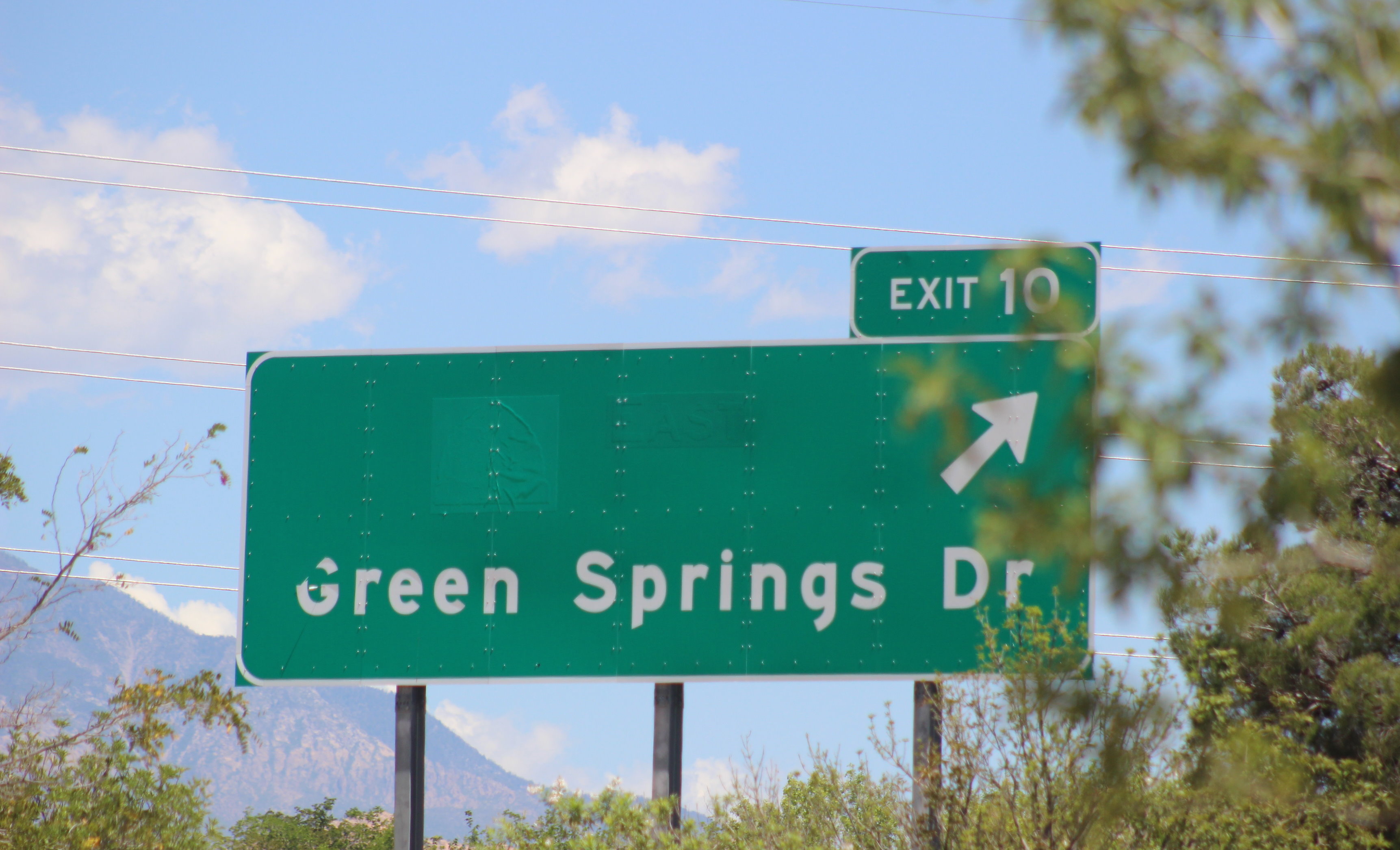
If the new road is expected to reduce traffic at the intersection of Green Springs and Telegraph, this corridor road will not satisfy that expectation. The traffic at this intersection if due to southbound Highway 15 travelers and local traffic going to the gas stations, fast food and shopping all closely connected in one location.
If tax income from the new road is a goal, then there are numerous other ways for tax revenue. Adding “out of state” tax to hotels, colleges, parks and boat launching would be a way to generate large sums of money without causing hardships to Utah residents.
As public representatives of the people in Washington County and City, we expect and hope our County Commission and City Council members will protect our land, lives, property values, health, and well-being.
Alternative options could include going around the airport area or other commercial areas. Other non populated areas on the other side of Interstate 15 could be another consideration for development of heavily traveled routes with high numbers of traffic. The responsibility of the Bureau of Land Management is to find the best alternative and the current request is not it.
Submitted by JOSEPH TROISE and JEANETTE SMITH, Washington City.
Northern Corridor Highway: Eating our cake and having it, too
When it comes to choosing the Northern Corridor Highway route, we can have the best of both worlds, eating our cake and having it too.
I have long supported the need for a Northern Corridor Highway (NCH), in large part because of the great respect I have for the Utah Department of Transportation (UDOT).
Transportation needs in Washington County have been met nicely for the 20 years I’ve lived here, usually in advance of significant traffic congestion. Those who don’t agree need to spend more time almost anywhere else in the country.
Since UDOT’s preferred NCH route runs through a portion of the Red Cliffs National Conservation Area (NCA) immediately north of St. George, the Bureau of Land Management (BLM) is required to prepare a Draft Environmental Impact Study (DEIS) that compares alternative solutions.
Like all of us, I’ve been urged to read the DEIS and send comments to the BLM. I’ll be honest: my eyes glazed over trying to read the 26 page Executive Summary and I was about to give up. I assumed that UDOT’s preferred route through the NCA was the only viable option to avert future traffic congestion.
Thankfully, an acquaintance pointed out that one of the BLM’s alternatives completely meets UDOT’s transportation requirements without going through the NCA and has essentially zero environmental impact. It’s all there in black and white in the BLM’s DEIS but well-hidden so as not to offend UDOT or other supporters of the NCA route.
Buried in Volume 3, Appendix J of the Highway Alternatives Development Technical Report, Horrocks Engineers supplies two tables comparing UDOT’s preferred NCA route with eight alternatives.
Table 4 on page 16 shows that modifications to create a Red Hills Parkway Expressway and adding “flyover” connections to I-15 does a better job reducing rush hour congestion at key intersections than does the UDOT preferred solution. Table 5 on page 17 shows that the Red Hills flyover results in better or identical peak hour travel times over a variety of routes.
I was shocked: A comparable or slightly better transportation solution with no NCA impact and without the inevitable lawsuits that will follow approval of a route through the NCA, delaying its implementation and adding to its cost. Regardless of how you feel about the desert tortoise, the alternative route looks like a winner.
What about cost? The Dixie Metropolitan Planning Organization (MPO) estimates that the first phase alone of UDOT’s preferred NCA route will cost $85 million; the MPO estimates that Phase 2 projects would add over $80 million more.
In addition, Washington County would need to spend $16 million over the next 25 years to administer the Zone 6 addition to the NCA if the NCA route is chosen.
The MPO refuses to provide an estimate for the Red Hills flyover alternative but in 2017 UDOT estimated a flyover would cost $17 million. Even allowing for flyover design modifications, a substantial modification to the Red Hills Parkway interchanges with Skyline Drive and 1000 East and various ancillary required upgrades, the flyover alternative would cost far less.

Ignoring the facts, the Dixie MPO dismisses the Red Hills flyover alternative by saying it “would render some traffic congestion relief, but based on concept studies, the flyover does not provide sufficient traffic relief needed by 2050 or even 2040.” The MPO offers no supporting data and its statement is completely at odds with Horrocks’ data in the DEIS.
The Dixie MPO goes on to complain that the alternative would require “extensive and difficult widening and environmental impacts throughout.” That’s arm-waving of the worst kind: widening an existing roadway can’t be more difficult than building a new roadway that will need extensive soil testing, grading and a number of small bridges over drainage channels and tortoise under-crossings. The MPO also contradicts the BLM’s statement which says environmental impacts from the Red Hills flyover would be “minimal.”
The MPO goes on to say that the flyover doesn’t provide “back-end” relief for Green Springs drivers to avoid congestion at the Green Springs freeway interchange. These drivers will have the new Washington Parkway linking them to I-15 Exit 13 and few of them would have any reason to go west through the NCA to Ivins or Santa Clara on a regular basis.
I’m an engineer; I deal with numbers and facts. If the Dixie MPO has real data to back up its arm-waving, we’ll all benefit from seeing it.
I’m 100 percent with our local leaders who back the need for a Northern Corridor Highway. But I suspect they don’t want to “inconvenience” their access to the Water Conservancy headquarters or to city facilities along the Parkway by examining a lower cost alternative, even when available data augurs for the Red Hills flyover and leaves the NCA intact.
Let’s eat our cake – the Red Hills flyover Northern Corridor Highway – and have it too, by preserving the NCA.
Submitted by HOWARD SIERER, Southern Utah.
A highway would turn the beauty of protected Red Cliffs Desert Reserve to dust
Our objection to the Northern Corridor Highway being built in the Red Cliffs Desert Reserve and National Conservation Area is associated with the discovery of St George and Washington when we were searching for a place to enjoy our winters away from the Midwest cold and snow.
We selected the Green Springs area due to its beauty and its great view of the Pine Valley Mountain. We could walk out of our house and be in the Red Cliffs Reserve in a short distance. This occurred almost every day, enjoying all that we were exposed to in those four-and five-mile hikes. We were told by Realtors and responsible people in the area that it would remain undeveloped due to the preservation of the Desert Tortoise.
This beautiful area, the mountain, the red rocks, the creation of the formations of rock layers over its history is something to be observed and revered forever. Left for the people of the future. Not marred by intrusions of roads.
The Northern Corridor Highway Draft Environmental Impact Statement (EIS) published by the BLM shares possibilities which minimize damage to ecological systems, vegetation and threatened species, like cheatgrass.
If the Northern Corridor is built through the National Conservation Area what will be the impact? If you change the beauty, the picturesque outdoors, the recreation we have at hand that is currently enjoyed by the residence nearby. What then? Maybe then due to growth and loss of our valued resources, we will dwell in the dust, heat and possible lack of water and wonder why we came to this area.
Submitted by BETTY ADAMSON, Washington City.
If you’re worried about the Northern Corridor now, just wait for the “Western Corridor”
We need to chat about a few things. Some of them you may have never heard of before, so let’s get some definitions out of the way before we get too deep into the conversation.
- Induced demand “is the phenomenon that after supply increases, more of a good is consumed.”
- Western Corridor is a road planned to flank the western side of St. George.
- Societal inertia “is the opposite of social change. It is the resistance to welcome change, the endurance of a society to maintain the standing order.”
Let’s jump right in as we have a lot to cover today.
Have you ever noticed that as soon as they finish widening a road to mitigate traffic, it pretty much needs to be done again? This phenomenon is a prime example of induced demand. Bigger, wider, faster roads are attractive to motorists trying to get from Point A to Point B as fast as possible. Every time you make those roads bigger, wider, faster, they immediately draw more motorists. These motorists are not new. There isn’t a sudden surge in people driving. Instead, people who may have used a slightly different route are now jumping on the new one because it’s, you guessed it, bigger, wider, faster.
We recently saw a prime example of this with the widening of Bluff Street in St. George. The road was busy prior to the expansion, but not overly so. The choke point was the intersection with St. George Boulevard which happens to be just a block north of where I work. Before making it bigger, wider, faster, cars would get backed up, but never more than a block or so and they never sat there for much more than the time it takes for the light to change.

During the construction, automobile congestion certainly worsened, but it never got so bad that people completely stopped using the road and at it’s worse, it still never was backed up for more than a couple of blocks. Motorists chose different routes, avoided the area or simply didn’t drive (there was an uptick in bikes on the road during certain phases as a giant section was blocked off and cars couldn’t go through).
Now that construction is complete and we have three lanes going both directions and a 45 mph speed limit, the choke point still exists. Traffic still gets backed up at about a block at a time and people have to wait a whole 90 seconds for the light to change.
This is induced demand. There are plenty of studies showing this phenomenon. I’m sure that everyone reading this has their own anecdote of witnessing this happen multiple times. The one thing you won’t find is a case study that suggests creating bigger, wider, faster roads will solve traffic. That’s because it doesn’t. It delays it, makes it impossible for people to choose their preferred method of transportation and effectively clogs a city of cars.
That brings us to the Western Corridor.
You might be thinking, “Wait, I thought we were fighting the Northern Corridor.” And you’d be right, but our current fight has consequences that will reverberate throughout the country and down the road. You see, this isn’t just a road through a desert. It is a road through a National Conservation Area. If it gets built, we will be setting a precedent that can and most likely will be used down the road to allow other roads through other conservation areas.
The County Commissioners and the BLM have offered up another chunk of land called Zone 6 as a way to abate the destruction of habitat by swapping one chunk for another, protecting a new region for the destruction of another. While we are all in on protecting Zone 6 and adding it to the Red Cliffs Desert Reserve, it does not solve the problem.
Remember that the Northern Corridor will be setting a precedent. The lands in Zone 6 are a combination of Utah State Trust Land, BLM lands and some Private. The big chunks that are controlled by the BLM are already protected. The Bear Claw Poppy Reserve keeps the space open and holds the same level of protection that would be offered under a Zone 6 swap. The part that isn’t often discussed is the Western Corridor.

For the Western Corridor to be built, the alignment goes right through the Bear Claw Poppy Reserve which would be a part of Zone 6. Now this wouldn’t happen for a while, hopefully, but if we set the precedent that it’s ok to build roads through our conservation areas, we will end up with nothing but roads. I can’t imagine a more dystopian future for Washington County.
Now, I know you’re getting anxious. The refreshments aren’t going anywhere. Sure, grab another beer. Let’s talk a quick minute about social inertia.
Just like everything else in the world, society, organizations, humanity has inertia. It often feels impossible to stop, change or even affect the direction that certain things are going. That’s the part that sucks about it. The good part, once we do change the direction, it’s much easier to maintain that momentum and make a change.
It feels like our biggest enemies in this fight are the BLM, the County Commissioners and other elected officials, but I don’t think so. Our biggest enemy is social inertia. There are too many people that think that nothing can be done, the decision is made and why fight. These are our biggest enemies. By staying silent they are contributing to the inertia and allowing it to roll right through.
We might not win, that’s a reality, but when it is all said and done, I hope like hell I can say I did my part, I did everything I could to protect our land and keep this asinine road from being built. Even if we lose, and I don’t think we will, I hope I can say that I did everything I could.
Submitted by LUKAS BRINKERHOFF, Southern Utah.
A balanced solution for our future: The need for the Northern Corridor in Washington County
Washington County is projected to have one of the most rapidly growing populations in the state of Utah, with an estimated 229% increase over the next 50 years. As your county commissioners, we are continuously looking for ways to take on this growth responsibly, with the well-being of our community and environment on the forefront. The Northern Corridor is a forward-thinking solution that balances the needs of our growing population and the importance of protecting the Red Cliffs Desert Reserve and the Mojave Desert Tortoise Habitat.
The Northern Corridor is a critical 4.25-mile roadway that will run from Exit 13 via Washington Parkway and connect into Red Hills Parkway near Highway 18. This roadway is an essential piece of transportation infrastructure, especially for the years to come. Traffic issues that may not seem like much of an inconvenience now, will only worsen as our population expands. Without the Northern Corridor resolution, commuters will be forced to idle at known pinch points, like Bluff Street and Sunset Boulevard and River Road and St. George Boulevard, sometimes sitting through three or four traffic light rotations. This will damage our air quality.
On the other hand, if the Northern Corridor is built, we anticipate commuters will save over 300,000 hours of traffic delays per year. Washington County is a beautiful place and it’s our responsibility to keep it that way. The development of this roadway will aid in preserving blue skies and clean air for future generations.
Thoughtful consideration went into finding the proper balance between a practical roadway and protecting the Mojave Desert Tortoise Habitat. We are confident that we have developed a smart solution that prepares us for the future without harming conservation efforts of the past and present. The Northern Corridor will impact approximately 3,000 acres of the existing reserve. To mitigate this impact, we will be adding Zone 6, which is 7,000 acres of land, to the Reserve. The vast majority of Zone 6 is currently available for commercial development. Washington County is offering a proposal that would turnover those lands to federal land managers in exchange for the Northern Corridor. Zone 6 is located west of Bloomington and is the home of many popular hiking and biking trails, including the Bear Claw Poppy Trail. It is also home to over 600 desert tortoises, while we estimate that only 20-50 tortoises may need to be moved out of the path of the Northern Corridor roadway.
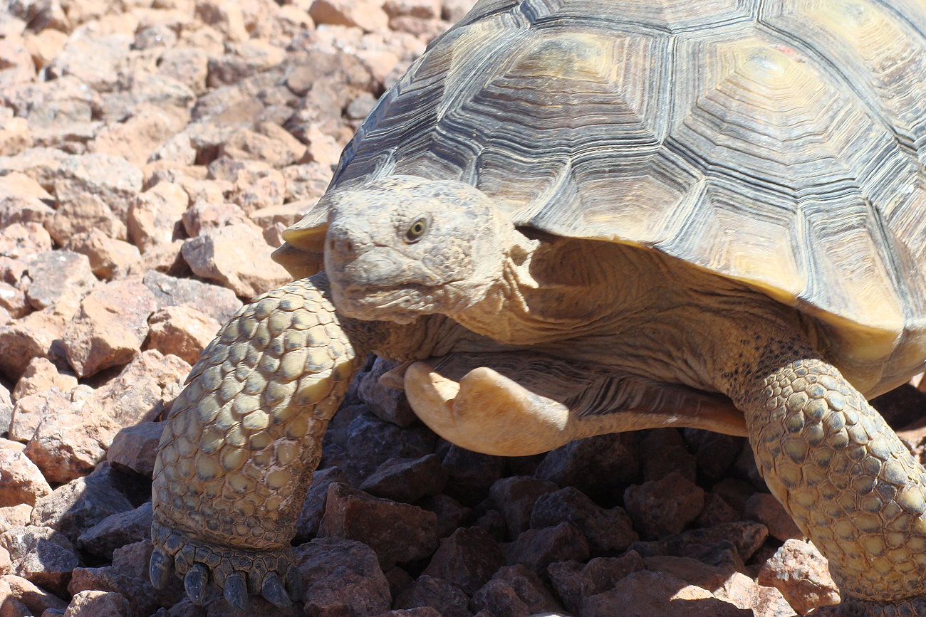
The tortoises in the existing reserve would maintain their original habitat, however, Washington County employs a team of biologists who have a plan to keep the tortoises safe should they come near harm during construction of the road. The biologists are also working on a tortoise transportation plan that will include bridges over and culverts under the road so tortoises may cross the road safely.
Washington County is committed to preserving quality of life for our residents -human and tortoise alike. We are also always thinking forward to the future. We want Washington County to be a place where our children can and want to live. The Northern Corridor has been in Washington County’s transportation plans for decades and has been thoroughly studied. It is not a hurried, half-baked solution nor an undercut to conservation efforts of the past. The offer to add Zone 6 to the existing reserve and protect hundreds of tortoises currently in danger further demonstrates our commitment to preservation.
We ask the public to support the “preferred alternative” in the Bureau of Land Management’s Draft Environmental Impact Statement which is currently up for review. The preferred alternative plan is Washington County’s Northern Corridor and Zone 6 proposal detailed above. It has the support of not only Washington County, but of the federal land management agencies as well. Even if you do not agree with our proposal as outlined, please still submit a comment. The majority of comments come from out of state. We want local voices to be heard as they will be the people most affected by this decision.
Submitted by the WASHINGTON COUNTY COMMISSION.
The public comment period for the Northern Corridor environmental impact statement runs through Thursday, Sept. 10. Comments can be submitted until then through the following methods:
- Standard mail: Bureau of Land Management, Attn: Northern Corridor, 345 East Riverside Drive, St. George, UT 84790.
- Email: [email protected].
St. George News thanks the many people who have offered their thoughts on the Northern Corridor. More information can be found in the related stories below.
Letters to the Editor are not the product of St. George News, its editors, staff or news contributors. The matters stated and opinions given are the responsibility of the person submitting them. They do not reflect the product or opinion of St. George News and are given only light edit for technical style and formatting.