A wind advisory from the National Weather Service means that sustained wind speeds of at least 31
mph or gusts of 45 mph are expected. Motorists should be prepared for sudden gusty crosswinds as driving may be difficult. Those driving high-profile vehicles and pulling trailers should take extra caution as those vehicles can be more vulnerable to crosswinds. This composite image includes a file photo of a semitractor-trailer overturned on the interstate. | Composite image, St. George News
ST. GEORGE — A gusty night is forecast for parts of Washington County – including St. George and surrounding communities – Monday night into Tuesday morning.
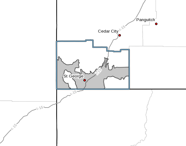
Shaded areas of this map denote those subject to a wind advisory issued by the National Weather Service. Radar map generated at 4:48 p.m. MDT, April 2, 2018 | Image courtesy courtesy of the National Weather Service, St. George News | Click on image to enlarge
The National Weather Service in Salt Lake City has issued a wind advisory in effect from 10 p.m. MDT Monday to 6 a.m. MDT Tuesday.
Affected area
North-south oriented canyons in Washington County are subject to the advisory, including Zion National Park and the St. George area.
Timing
North to northeast winds of 25 to 35 mph with gusts in excess of 50 mph are expected to develop in the evening and continue through the night.
Precautions
Strong crosswinds can be expected along east-west oriented roadways. High-profile and lightweight vehicles will be most susceptible to these strong winds.
Motorists in the advisory area should be prepared for sudden gusty crosswinds, which can make driving difficult.
Copyright St. George News, SaintGeorgeUtah.com LLC, 2018, all rights reserved.
ABOUT THE AUTHOR
Joseph Witham is a passionate journalist who has written, reported and edited for various publications since 2001. He is a Utah Valley University graduate with a bachelor's degree in communication. He loves Southern Utah's outdoors and hikes often in the region's red-rock canyons.