ST. GEORGE — A storm system is forecast to bring light snow to higher elevations and gusty canyon winds to parts of Southern Utah this weekend. Temperatures in the St. George area will drop some in the coming week, but it could be worse.
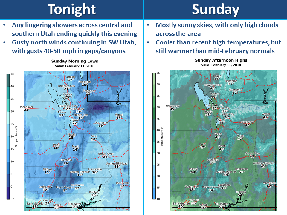
An incoming storm system is bringing a colder air mass and light snow to the western two-thirds of Utah Saturday, according to a hazardous weather outlook issued by the National Weather Service. Gusty canyon winds of 40-50 mph will be possible Saturday night in Washington County.
Periods of generally light snow will be possible across northern Utah Sunday night and Monday and over the higher elevations of Southern Utah Monday night into Tuesday.
Regionally affected areas include southwest Utah, Utah’s Dixie, Zion National Park, south-central Utah, Glen Canyon National Recreation Area-Lake Powell and southern mountains.
St. George – the week ahead
According to The Weather Channel’s forecast, the St. George area will enjoy a mostly-sunny day Sunday but then faces mostly partly-cloudy days through Friday with a chance of morning rain Tuesday. After a week of high 50s and low 60s, temperatures in the area should rise into the high 60s for a sunny weekend forecast.
How the mercury does rise and fall in Dixie. For those ruing a few cooler days after a fairly warm winter season thus far, consider: On this date in 1933, the temperature in St. George was 5 degrees, according to intellicast.com’s local history webpage. Then again, in 1951 on this date, it was 75 degrees.
St. George News Editor-in-Chief Joyce Kuzmanic contributed to this report.
Email: [email protected]
Twitter: @STGnews
Copyright St. George News, SaintGeorgeUtah.com LLC, 2018, all rights reserved.