National Weather Service updates
- UPDATE: 1:55 p.m. – The NWS has issued a significant weather advisory for Kane County, including Glen Canyon Recreation Area/Lake Powell. See full update below.
- UPDATE: 1:18 p.m. – The NWS has issued a significant weather advisory for Garfield County. See full update below.
- UPDATE: 1 p.m. – The NWS has upgraded a flash flood watch for Kane and Washington counties, including Zion National Park, to a flash flood warning. See full update below.
- UPDATE: 12:50 p.m. – The NWS has upgraded a significant weather advisory for Kane and Garfield counties. See full update below.
- UPDATE: 11:30 a.m. – The NWS has upgraded a flash flood watch for Iron County to a flash flood warning. See full update below.
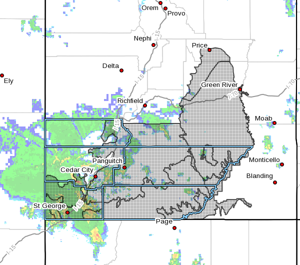
SOUTHERN UTAH — The National Weather Service in Salt Lake City has issued a significant weather advisory for Washington County Thursday, along with a flash flood watch for Washington, Kane, Iron, Beaver and Garfield counties.
Significant weather advisory

At 8:28 a.m. Thursday, National Weather Service Doppler radar indicated a strong thunderstorm 10 miles north of Beaver Dam, moving northeast at 45 mph.
“Penny to nickel size hail and wind gusts of 40 to 55 mph will be possible,” the weather advisory stated, noting:
“If threatening weather approaches, take shelter in a sturdy building. Torrential rainfall is also occurring with this storm, and may lead to localized flooding. Do not drive your vehicle through flooded roadways.”
Affected area
Locations impacted by the significant weather include Santa Clara, Ivins, Motoqua, Gunlock, Veyo, Snow Canyon State Park and Goldstrike.
UPDATE: The National Weather Service has issued a significant weather advisory for Kane County and Garfield County until 1:15 p.m.
At 12:49 p.m., National Weather Service Doppler radar indicated a strong thunderstorm 16 miles south of Hatch, or 27 miles north of Kanab, moving north at 30 mph. Locations impacted include Hatch, Tropic and Alton.
UPDATE: The National Weather Service has issued a significant weather advisory for central Garfield County until 1:45 p.m.
At 1:18 p.m., National Weather Service Doppler radar indicated a strong thunderstorm over Escalante, moving northeast at 35 mph. Locations impacted include Escalante and Boulder.
UPDATE: The National Weather Service has issued a significant weather advisory for Kane County, including Glen Canyon Recreation Area/Lake Powell. Locations impacted include rural portions of eastern Kane County west of Lake Powell.
At 1:53 p.m., National Weather Service Doppler radar indicated a strong thunderstorm 14 miles northeast of Wahweep, or 19 miles north of Page, moving northeast at 30 mph.
Flash flood watch
Several rounds of heavy rainfall associated with widespread showers and scattered strong thunderstorms are forecast in parts of Southern Utah late Thursday morning into Thursday evening.
Affected area
A flash flood watch has been issued for portions of Washington, Kane, Iron, Beaver and Garfield counties and southern mountains, including Utah’s Dixie and Zion National Park, Glen Canyon Recreation Area/Lake Powell, Capitol Reef Castle Country and the San Rafael Swell and the cities of St. George, Kanab, Escalante, Price, Castle Dale, Emery, Green River, Hanksville, Bullfrog, Loa, Panguitch, Bryce Canyon, Beaver, Cedar City and Milford.
Timing
The watch is in effect from 10 a.m. Thursday through Thursday evening. The threat should diminish from west to east midafternoon into the evening.
Impacts
Flash flood prone areas include the Brian Head burn scar, slot canyons, normally dry washes and small streams. Rainfall may be extensive enough to cause localized urban flooding, including water flowing over roadways. The heavy rainfall may cause travel difficulties on normally dry dirt roads.
Precautionary, preparedness actions
A flash flood watch means that conditions may develop that lead to flash flooding. Flash flooding is a very dangerous situation.
The public should monitor later forecasts and be prepared to take action should flash flood warnings be issued.
UPDATE: Flash flood warning
Washington County and Kane County
The National Weather Service has issued a flash flood warning for east-central Washinton County and western Kane County until 4:45 p.m. Thursday.
At 12;48p.m., Doppler radar indicated a thunderstorm producing heavy rain over Zion National Park and areas to the southwest. Storm trajectories will place heavy rainfall over North Creek and it’s tributaries within the park shortly. Additionally, the North Fork of the Virgin River is expected to receive heavy rainfall and flash flooding.
“If you are within Park Boundaries or in any of the small streams within the warning, please take steps to ensure for your safety,” the weather service alert noted.
Iron County
The National Weather Service has issued a flash flood warning for east-central Iron County in Southern Utah until 2:15 p.m. Thursday.
At 11:11 a.m., Doppler radar indicated brief heavy rainfall has fallen over the Brian Head burn scar. Radar indicates that an inch has fallen in a short period of time. Some locations that will experience flooding include Parowan and Brian Head.
“Impacts include debris and flood waters on state Route 143 and surrounding secondary roads,” according to the weather service. “These storms are fast moving and flash flooding is expected to be short lived.”
Turn around. Don’t drown.
The National Oceanic and Atmospheric Association and the National Weather Service offer safety rules for flash flooding:
- Flash flooding is a very dangerous situation.
- Flash flood waves, moving at incredible speeds, can roll boulders, tear out trees, destroy buildings and bridges and scour out new channels. Killing walls of water can reach heights of 10 to 20 feet. You will not always have warning that these deadly, sudden floods are coming. When a flash flood warning is issued for your area or the moment you first realize that a flash flood is imminent, act quickly to save yourself. You may have only seconds.
- Most flood deaths occur in automobiles. Do not drive your vehicle into areas where the water covers the roadway. Flood waters are usually deeper than they appear. The road bed may not be intact under the water. Just one foot of flowing water is powerful enough to sweep vehicles off the road. If the vehicle stalls, abandon it immediately and seek higher ground. Rapidly rising water may engulf the vehicle and its occupants and sweep them away.
- Do not hike rivers and especially slot canyons while flash flood warnings are in place.
- Do not hike alone and always tell someone where you and your buddy and others are going.
- Get out of areas subject to flooding, including dips, low spots, canyons and washes.
- Avoid already flooded and high velocity flow areas. Do not try to cross a flowing stream on foot where water is above your knees.
- Be especially cautious at night when it is harder to recognize flood dangers.
- Do not camp or park your vehicle along streams and washes, particularly during threatening conditions.
During any flood emergency, stay tuned to your NOAA weather radio, commercial radio or television, follow St. George News at STGnews.com and St. George News Facebook for weather alerts and updates relevant to Southern Utah. Information from the National Weather Service and disaster and emergency services may save your life.
Email: [email protected]
Twitter: @STGnews
Copyright St. George News, SaintGeorgeUtah.com LLC, 2017, all rights reserved.
I am guessing this was meant for Thursday and not Tuesday?
Brittney, thanks for bringing this to our attention. We did indeed miss that, but it has been remedied. And I, for one, am pleased to say that today is actually Thursday. It’s been a long enough week already 🙂
Thanks for reading St. George News.
Paul Dail
ST. GEORGE NEWS
Editor, Reporter