WASHINGTON COUNTY – The National Weather Service out of Salt Lake City has issued a winter weather advisory for parts of central and Southern Utah effective 2 a.m. Thursday through 5 a.m. Friday.
Snowfall will start early Thursday morning and become widespread across the Wasatch plateau southward to the southern mountains, continuing throughout the day.
The snow will taper off early Friday morning.
Affected areas
The Wasatch plateau southward across the central and southern mountains includes the communities of Scofield, Cove Fort, Koosharem, Fish Lake, Loa, Panguitch and Bryce Canyon.
Snow levels and accumulation
New snowfall of 4 to 12 inches is expected, with totals towards the higher end of the range occurring across the southern mountains.
Impacts
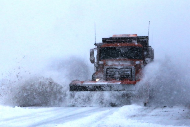
Winter driving conditions will develop on all mountain routes including US Highway 6 over Soldier Summit, Interstate 70 between Cove Fort and Fremont Junction, and the higher passes along Interstate 15 south of Fillmore.
Precautionary/Preparedness actions
A winter weather advisory for snow means that snow accumulations will make travel difficult. Be prepared for snow covered roads and use caution while driving in the snow.
Getting ready
- Be aware of road conditions. UDOT recommends checking CommuterLink for road and weather conditions before leaving home.
- Clear any frost and snow from the car’s lights and windows. Make an effort to see and be seen while driving.
- Inspect the vehicle’s tires, fluids, wiper blades, lights and hoses. Preventative maintenance may save a car from breaking down and stranding drivers and passengers on the highway.
- Allow for leeway in travel time. Expect to drive slowly in adverse weather conditions. High speeds can lead to skidding off the road and getting stuck in the snow.
- Have emergency supplies in the car. A basic winter emergency kit may include items like a flashlight, batteries, snacks, water, gloves, boots and a first-aid kit.
When Driving
- Take it slow. Drive well below posted speed limits and leave plenty of space between cars.
- Approach intersections, off-ramps, bridges and shaded areas slowly. These areas are hot spots for black ice.
- Slow down in cases of limited visibility and be alert.
- Whether someone drives an elevated SUV or a ground-kissing Toyota Prius, again, UDOT says to take it slow. Just because a truck has 4-wheel drive doesn’t change how it handles on the road, especially when traction goes out the window. Mother Nature is no respecter of automotive diversity.
- Keep the vehicle’s speed down. The faster the car goes, the longer it takes to stop. Be slow on the accelerator or risk having the car skid when the next stop sign appears.
- Do not use the car’s cruise control while ice and snow still abound.
Additional information on winter driving can be found at the UDOT website, as well as UDOT’s Commuterlink for current road and weather conditions, or dial 511.
Weather watches, warnings and advisories issued by the National Weather Service Forecast Office in Salt Lake City can be found here.
Email: [email protected]
Twitter: @STGnews