ST. GEORGE – A flash flood watch and a warning has been issued for the southern Utah region by the National Weather Service in Salt Lake City.
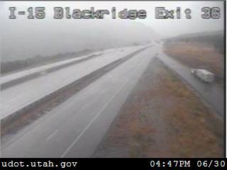
Heavy rainfall and slick roads are contributing to dangerous driving conditions throughout the area.
The flash flood watch is in effect from Friday afternoon through evening.
Counties included in the alert are Washington, Garfield, Kane, San Juan, Sevier and Wayne counties.
The San Rafael Swell and south central Utah are included in the flash flood watch.
Normally dry washes, small streams, slot canyons and area streams in steep terrain will be most prone to flooding.
Travel will become difficult on backcountry roadways as flooding develops and the potential for muddy conditions increases.
Scattered showers and thunderstorms are developing with locally heavy rainfall expected throughout the day and evening Friday. Lightning strikes are accompanying the storms.
Flash flooding is a very dangerous situation. Authorities advise motorists to slow down since dry roads that receive moisture are slick and dangerous. Never drive into water.
Email: [email protected]
Twitter: @STGnews