ST. GEORGE – The National Weather Service in Salt Lake City has issued a wind advisory for areas across Utah in effect from 6 p.m. Saturday to 6 p.m. Sunday.
Areas affected
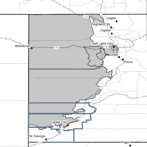
Salt Lake and Tooele valleys, west-central and southwest valleys of Utah, Great Salt Lake Desert and mountains, including among others the following cities: Salt Lake City, Tooele, Wendover, Snowville, Delta, Fillmore, Beaver, Cedar City and Milford. See map inset for more detail.
Winds
Southerly winds of 25- 35 mph with gusts approaching 55 mph are forecast by the weather service. Winds are expected to shift to the northwest and remain strong behind a cold front crossing the affected areas Sunday.
Timing
Southerly winds will develop across western Utah Saturday then increase significantly Saturday evening.
The southerly winds will be strongest ahead of a cold front moving through northern and western Utah Sunday morning through early afternoon.
Strong northwest winds will trail the cold front then decrease rapidly beginning early Sunday evening.
Impacts
Travel along west-to-east routes, including Interstate 80, U.S. Highways 50 and 6 and state Route 30, among others, will be impacted by strong and shifting crosswinds.
High-profile and lightweight vehicles will be subject to hazardous travel conditions Saturday night through Sunday.
Precautionary and preparedness actions
A wind advisory means that sustained wind speeds of at least 31 mph or gusts of 45 mph are expected. Motorists in the advisory area should be prepared for sudden gusty crosswinds that can make driving difficult.
Resources
- Visit UDOT’s Road Weather Alerts
- Obtain UDOT’s smartphone travel app
Email: [email protected]
Twitter: @STGnews