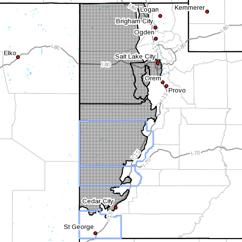
SOUTHERN UTAH — The National Weather Service in Salt Lake City has issued a high wind watch for parts of Washington, Iron and Beaver counties in effect Thursday morning through Thursday evening.
Affected areas
The Salt Lake and Tooele valleys, Great Salt Lake Desert and west central and southwest Utah, including the cities of Fillmore, Beaver Cedar City, Wendover, Snowville, Salt Lake City, Tooele, Delta and Milford.
Winds
South to southwest winds 30-40 mph with gusts in excess of 55 mph
Timing
Winds will increase Thursday morning and become strong by Thursday afternoon. Winds will gradually decrease during the evening hours as a cold front crosses Northern Utah.
Impacts
Strong crosswinds are expected along east-west routes across Western Utah, especially Interstate 80 and highways 6 and 50, as well as portions of Interstate 15. Wind-sensitive operations will be affected.
Precautionary/preparedness actions
A high wind watch means there is the potential for a hazardous high wind event. Sustained wind speeds of at least 40 mph or stronger may occur. Continue to monitor the latest forecasts.
Email: [email protected]
Twitter: @STGnews
Copyright St. George News, SaintGeorgeUtah.com LLC, 2015, all rights reserved.