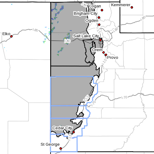
ST. GEORGE — The National Weather Service in Salt Lake City has issued a red flag warning, a wind advisory and a high wind watch for conditions expected to occur Friday and Saturday in several Southern Utah counties, including Washington, Iron, Beaver and Millard.
Wind advisory, high wind watch
A wind advisory is in effect from 10 a.m. to 10 p.m. Friday. A high wind watch has also been issued and is in effect from Saturday morning through Saturday evening.
Affected area
The Salt Lake and Tooele Valleys, Great Salt Lake desert, west central and southwest Utah.
Winds
Southwest winds up to 20 to 30 mph with gusts of 50 mph are expected Friday, increasing to 25 to 35 mph with the potential for gusts to exceed 60 mph Saturday. Winds will shift from the southwest to the northwest Saturday afternoon and evening.
Timing
Winds will become gusty late Friday morning, lasting into the evening hours. Gusty winds Saturday should begin earlier in the morning and last through the remainder of the day.
Impacts
Expect strong crosswinds to develop on Interstate 80, Highway 6 and state Routes 56 and 21. Those operating high-profile vehicles and vehicles with trailers should use extra caution. Visibilities may be reduced below a mile locally due to blowing dust. Wind sensitive operations will be impacted.
Precautionary/preparedness actions
A wind advisory means sustained wind speeds of at least 31 mph or gusts of 45 mph are expected. Motorists in the advisory areas should be prepared for sudden gusty crosswinds, which can make driving difficult.
A high wind watch means there is the potential for a hazardous high wind event. Sustained wind speeds of at least 40 mph or gusts of 58 mph or stronger may occur.
Red flag warning
A red flag warning has been issued for wind and low relative humidity and is in effect from 10 a.m. Friday to 10 p.m. Saturday.
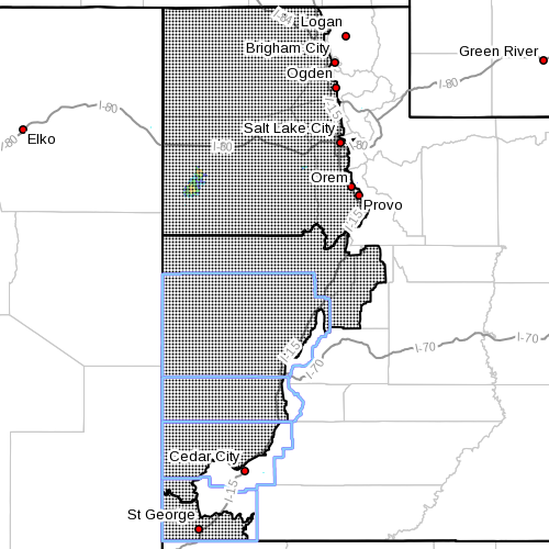
Affected area
Fire weather zone 478 Salt Lake desert, fire weather zone 492 central Utah west desert, fire weather zone 495 Color Country west desert and fire weather zone 497 Mojave Desert.
Winds
South winds up to 25-35 mph with gusts up to 50 mph will develop Friday. Winds may decrease a bit overnight Friday but will increase again during the day Saturday and could potentially be even stronger than Friday.
Relative humidity
10-15 percent in the afternoons with poor overnight humidity recovery
Impacts
The combination of low relative humidity and gusty winds will create hazardous fire weather conditions Friday and Saturday.
Precautionary/preparedness actions
A red flag warning means critical fire weather conditions are either occurring now or will shortly. A combination of strong winds, low relative humidity and warm temperatures can contribute to extreme fire behavior.
Related posts
- Early morning fireball attracts attention
- Lightning, fire chasers, drones; how you can help
- Early morning fire likely caused by discarded ‘smoking materials’
Email: [email protected]
Twitter: @STGnews
Copyright St. George News, SaintGeorgeUtah.com LLC, 2015, all rights reserved.