SOUTHERN UTAH – The National Weather Service in Salt Lake City has issued a winter weather advisory for the mountain areas of Southern Utah in effect until 3 a.m. Sunday.
Affected area
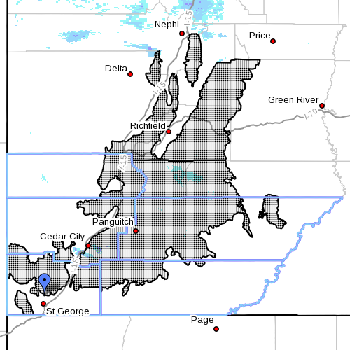
The affected area includes the southern and central mountains of Utah.
Timing
Light snow late Saturday afternoon will become more widespread and heavier early Saturday evening. Periods of heavy snow will continue until around midnight before tapering off from the north.
Impacts
All higher elevation roadways will become covered by midevening and hazardous travel conditions will exist overnight. Snow accumulations of around 2-5 inches are expected, with great amounts over the southern mountains.
Precautionary/preparedness actions
A winter weather advisory for snow means snow accumulations may cause travel difficulties. Be prepared for snow-covered roads. Use caution while driving.
For winter road conditions, visit the Utah Department of Transportation website or dial 511.
Related posts
- NWS issues ‘high wind watch,’ forecasts 60 mph gusts
- Winter weather advisory for Southern Utah mountains
- Ice and snow, take it slow: Winter Driving tips from UDOT
Email: [email protected]
Twitter: @MoriKessler
Copyright St. George News, SaintGeorgeUtah.com LLC, 2014, all rights reserved.
Driving into St. George tonight I saw huge chunks of snow that appeared to have fallen off of semis. One was probably over 2ft round. Lots of smashed snow in the lanes too. It’s 45’f here but must be snowing like crazy somewhere.
GLOBAL WARMING