SOUTHERN UTAH — The National Weather Service in Salt Lake City has issued a winter weather advisory for the mountain areas of Southern Utah, effective from 5 a.m.-4 p.m. Friday.
The advisory warns of 3-6 inches of snow for areas above 8,000 feet.
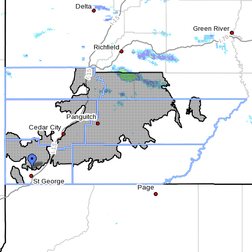
Affected areas
The areas forecast to be affected by the winter weather are Washington County, Beaver County, Garfield County, Kane County and Iron County, along with Loa, Bryce Canyon and Panguitch.
Snow levels
Between 3-6 inches of snow is expected, with the bulk of the accumulation remaining in areas 8,000 feet above sea level.
Snow will begin to fall Friday morning and then intensify as the day continues into the afternoon.
Impacts
A winter advisory for snow means snow accumulations will primarily cause travel difficulties. Those traveling are encouraged to be prepared for snow-covered roads and to use caution while driving.
Winter driving conditions are also to be expected on high mountain passes, specifically state Highways 143, 14 and Boulder Summit.
Resources
Winter road condition information from the Utah Department of Transportation is available here or by dialing 511.
Related Posts
- Don’t let your trees freeze; arborist offers advice
- Will Dixie’s palm trees survive the freeze?
- Snowmen in St. George, with a few other masterpieces; STGnews Photo Gallery
- Snowstorm preparedness: Accidents happen, emergent needs arise; local professionals offer help
Email: [email protected]
Twitter: @STGnews
Copyright St. George News, SaintGeorgeUtah.com LLC, 2014, all rights reserved.