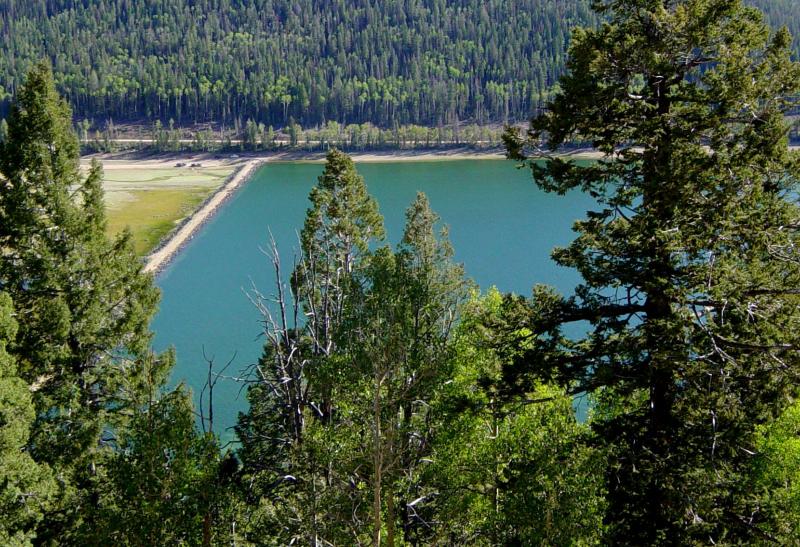
FEATURE – In this report, we’re going to get high – altitude, that is! Higher altitude means lower temperatures, and at roughly 9,000 feet above sea level, the Navajo Lake Trail is a favorite “get away from the heat” bike rides for mountain bikers.
This is a really fun trail for just about anyone. Newbies will enjoy its rolling hills and generally smooth conditions, while more advanced riders will be challenged by doing laps (the trail can be ridden in either direction), riding faster or adding in connectors to the higher altitudes of the Virgin River Rim Trail.
To get there, take Interstate 15 north to the first Cedar City exit, heading through town until you see the turn west for Highway 14 up Cedar Canyon. Continue along this gorgeous road, getting off at Navajo Lake. Drive down this dirt road about a mile and you’ll see a trail sign for the north side of the Navajo Lake Trail. There’s a good parking area another quarter mile down the road, although the trail can be accessed from any of the camping and picnic areas around the lake.
The north side of the lake is generally easier, although you will go through an old lava flow on the east end that can be loose, so some may opt to walk this part. The upside is that the views are great and this section is short, so you’ll soon be back on the bike.
The trail continues just above the shoreline in an aspen and pine forest, with smile-inducing undulating, twisty terrain, over to the Te Ah Campground. Here you’ll have some options. You can get on the road east and head back to the car, get on the road east for about a half mile and hook south when you see the Lodge Trail or get on the road west and turn south at the Virgin River Rim Trail sign, which will take you higher up the mountain to summits overlooking all points south, including Zion National Park.

You can then choose to drop back down to the lake on several connector trails. One favorite is the Dike Trail. It’s fast and has quite a few switchbacks. The main trail around the lake is about 11 miles long, with many options to make it longer and several “bailouts” along the way if the going gets tough or the weather turns nasty.
Speaking of weather, even if it’s warm in St. George, be prepared for rapid changes at higher altitude. Rain and even hail are not unheard of up there – not to mention snow. Highway 14 is plowed during daytime hours only. To check for road conditions and closures visit Utah Department of Transportation’s seasonal road closure webpage.
Be safe, get out and have a fun ride!

Written by Jay Bartlett for St. George Health and Wellness magazine and St. George News.
Bartlett is an avid mountain biker currently working as a mechanic and salesman at Bicycles Unlimited. He has extensive experience with all the local trails and is a wealth of information.
Related posts
- Trail review: Church Rocks Trail, a skill-building mountain bike adventure
- STGnews LifeCYCLE: Two-wheeled travels, Southern Utah upcoming events
- Digital Ranger app for navigating national parks, forests; Southern Utah family’s mission fundraiser turns big business
Now available from STGnews.com
St. George News App for Android®
St. George News App for iPhone®
St. George Health and Wellness
Email: [email protected]
Twitter: @STGnews
Copyright St. George News, StGeorgeUtah.com Inc. and St. George Health and Wellness magazine, 2013, all rights reserved.

Great trail, but also under snow for the next 6 months.
This a nice well written article about a beautiful area…having said that, why exactly would anyone be looking for a trail to beat the heat in Utah at the end of November?? I’m guessing this trail is probably under several inches of snow at the moment. Maybe publish this again next June
Looks like someone on the editing staff had a case of the Fridays …quick we need an outdoorsy article for the week of thanksgiving… Oh look, here’s one that Jay wrote for us 4 months ago- let’s use this.
Oops