UTAH – The National Weather Service has issued a Special Weather Statement forecasting a wet week in store for much of Utah and southwest Wyoming.
Weather system incoming
A low pressure system currently centered along the northern California coast will drift south Monday then turn east and arrive over the southern great basin Tuesday. This low pressure system will move slowly east through the southwestern United States this week resulting in a long duration precipitation event for much of Utah and southwest Wyoming.
Monday-Tuesday – southern Utah
Moisture moving up from the south ahead of the low will bring scattered showers and isolated thunderstorms to mainly the southern two-thirds of Utah on Monday. The areal coverage and intensity of these showers and thunderstorms will increase Monday night through Tuesday as the low pressure moves into the great basin.
Tuesday – southern Utah
Widespread precipitation will settle into the area with the arrival of the storm Tuesday night.
Wednesday – central and northeast Utah
The heaviest amounts will be confined to areas north of the low center across central and northeast Utah Wednesday through Wednesday night.
Valley rain, high elevation snow – southern and central Utah
Valley locations will stay primarily in rain, with the higher elevations of southern and central Utah receiving several inches of snow.
End of the week showery
The end of the week will see precipitation turn showery and shift more towards the southern and eastern portions of the state.
Fair weekend
High pressure will bring an end to any remaining organized precipitation by the weekend.
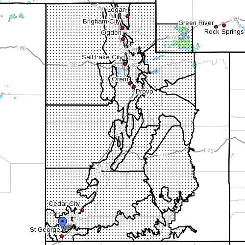
Affected areas
Cache Valley, portion of northern Wasatch Front, Salt Lake and Tooele valleys – southern Wasatch Front, Great Salt Lake desert and mountains – Wasatch Mountain valleys, Wasatch Mountains Interstate 80 North – Wasatch Mountains south of I-80, Western Uinta Mountains – Wasatch Plateau/Book Cliffs, Western Uinta Basin – Castle Country – San Rafael Swell, Sanpete/Sevier valleys – west central Utah – southwest Utah, Utah’s Dixie and Zion National Park – south-central Utah; Glen Canyon Recreation Area/Lake Powell – central mountains; southern mountains – southwest Wyoming.
For road conditions from the Utah Department of Transportation:
Visit UDOT’s Road Weather Alerts / Obtain UDOT’s smartphone travel app.
Email: [email protected]
Twitter: @STGnews