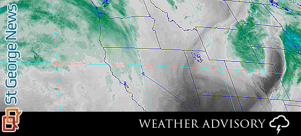
UTAH – The National Weather Service has issued a Special Weather Statement about the next pacific storm system to impact Utah beginning later this week.
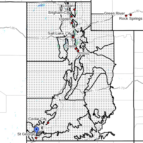
Affected areas: Cache Valley / Utah portion, northern Wasatch front, Salt Lake and Tooele Valleys, southern Wasatch front, Great Salt Lake desert and mountains, Wasatch mountain valleys, Wasatch Mountains Interstate 80 north, Wasatch mountains south of I-80, western Uinta mountains, Wasatch plateau / Book Cliffs, western Uinta basin, Castle Country, San Rafael Swell, Sanpete / Sevier valleys, west central Utah, southwest Utah, Utah’s Dixie and Zion National Park, south central Utah, Glen Canyon Recreation area / Lake Powell, central mountains, southern mountains and southwest Wyoming.
Storm system: A cold pacific storm system will reach the Pacific Northwest coast on Wednesday. The cold front associated with this storm will settle into northwest Utah Wednesday evening then stall across the area through Thursday.
Wednesday-Thursday valley rain, mountain snow: This front will become the focus for valley rain and mountain snow Wednesday night through early Thursday evening. Substantial amounts of rain and or snow are possible with the greatest amounts over the northern Wasatch mountains, the Cache valley and the northern Wasatch front.
The center of the storm will shift south from the Pacific Northwest and into the southern great basin by late Friday. This storm will then track slowly east across northern Arizona through Saturday.
Friday-Saturday rain and snow for southern and central Utah: Widespread moderate to heavy precipitation will develop across southern and central Utah Friday night then continue into early Saturday evening.
Heavy snow is likely for the southern and central mountains with amounts between one and two feet likely. The northern mountains will also see accumulating snow though amounts are expected to be substantially less.
The southern and central valley locations will initially see precipitation in the form of rain with this rain changing over to snow at most valley locations by late Friday night or early Saturday.
Accumulations: Several inches of accumulation are possible, especially for the higher southern valleys. Snow will begin to wind down Saturday night as the center of the storm moves into the southern and central Rockies. Accumulating snows will linger into Sunday morning, with most of any additional accumulations confined to the higher terrain.
Impacts: Significant impacts are anticipated from this slow moving winter storm.
For winter road conditions from the Utah Department of Transportation:
Visit UDOT’s Road Weather Alerts.
Obtain UDOT’s smartphone travel app
Email: [email protected]
Twitter: @STGnews