ST. GEORGE — Weekend travel along Interstate 15 and other state highways may be complicated with snowfall in high-altitude locations.
The Utah Department of Transportation released a road weather alert in effect until noon Sunday advising of affected routes.
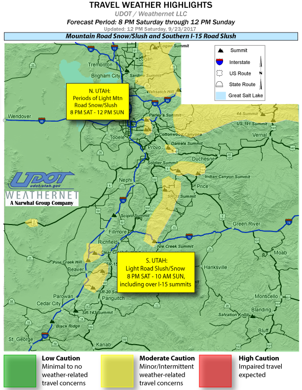
An early season storm system moving through the state will bring snow showers across a wide swath of Utah Saturday night through Sunday.
The storm’s main impacts are expected above 7,000 feet for northern Utah and above 6,000 feet for southern Utah. Summits above 6,000 feet along I-15 and I-70 in southern Utah can expect light road slush late Saturday night through very early Sunday morning.
Mountain summit routes for northern Utah can expect light road snow slush late Saturday through early Sunday afternoon under continued snow showers.
The following major routes are expected to have weather-related travel concerns during the forecast period:
- Interstate 80, Parleys Summit to the US-40 junction; Wasatch Hill near Wyoming border.
- Interstate 70, I-15 Junction over Clear Creek summit; Ivie Creek summit.
- Interstate 15, summits (above 6,000 feet) between Cove Fort and south to beaver Ridge.
- U.S. Route 89, Logan summit and upper canyon.
- U.S. Route 40, Daniels Summit.
- U.S. Route 6, Soldier Summit.
Up-to-date road conditions can be found at the UDOT website.
Email: [email protected]
Twitter: @STGnews
Copyright St. George News, SaintGeorgeUtah.com LLC, 2017, all rights reserved.