OPINION — Just when I think I can write a positive piece about the proposed Northern Corridor – a road to link traffic across Washington County – I find that I’m faced with a dilemma. One the one hand, I’d like to be able to give the county commissioners credit for doing what’s right for our county, but faced with the facts, that’s difficult to do. I think we can all agree that we want an efficient transportation system in this county; in question is whether their proposed road is the best way to achieve that.
Applegate, St. George News
I’ve studied the proposed Northern Corridor highway issue for over 10 years and the history before then, too. County and city leaders continue to assert that a preferred route to move traffic east and west to relieve congestion has always been on the maps and in the plan. But a little history shows that to be questionable.
The Red Cliffs Desert Reserve (now mostly a National Conservation Area), established in 1996, via the Habitat Conservation Plan (HCP) has allowed growth to flourish with few restraints while offering protections to threatened and endangered species including the Mojave Desert tortoise population.
Leaders signed an agreement to preserve the reserve in exchange for development of 300,000 acres outside of the reserve. Now leaders seem to want to renege on the agreement. Senators and a representative have been enlisted to run bills that seem to exempt the highway from environmental regulations and force it though the reserve, ignoring the signed agreement.
Growth accelerated in the early 2000s. Past reserve meeting minutes reveal much discussion about the highway. City and county leaders now assert that their “preferred” road route – I-15 mile post 13 to Red Hills Parkway bisecting the reserve – has always been in the plans and on the map. Evidence is to the contrary.
Meeting minutes from 2006 state, “…when the HCP was negotiated, a northern beltway was discussed but ultimately excluded. Bisecting the reserve with a beltway would be a major impact and would threaten the viability of the HCP.”
2006 Habitat Conservation Advisory Committee (HCAC) members Jim Crisp (BLM) and Henry Maddux (UDNR) both mentioned a potential road that would address the county’s growth and reserve concerns. They asserted that a roadway even further north would accommodate the northward expansion of the County. However, that idea would take citizens too far from the shopping area so St. George did not take to that. By unanimous vote the group agreed to look at various routes “not bisecting” the reserve.
At the following 2006 meeting, Commissioner (Alan) Gardner and St. George Mayor (Dan) MacArthur came to the HCAC to reopen the issue. At that time Utah’s Congressional delegation was running Senate and House bills regarding county land issues with a map on which they wanted a highway. Gardner and MacArthur argued that a “line on the map” was required so future planners would not misinterpret what had been planned all along. Minutes indicate then the City preferred an end point between Diamond Valley and Winchester on the west side, which, interestingly, is not where their current preferred route ends. After much back and forth, a motion was unanimously passed stating there would be “…a map annotation or Bill language, and not a line on the map.”
Fast forward to 2017. Again the road is a focus. The county is holding meetings with stakeholders as part of the HCP 20-year renewal process. Road planners want a road from I-15 mile post 13 in Washington City to Red Hills Parkway – a road already busy and getting busier.
At the May 2 meeting I witnessed much discussion about other highway options, too, which is good. However, in the meantime, Sens. Hatch and Lee and Congressman Stewart were working in the background through Congress (S.1053 and H.R.2423) apparently to force a highway through the reserve – basically taking the decision to D.C. and perhaps making the county meetings just for show.
While they’re working through the D.C. sausage-making process, Commissioner Cox recently wrote in his Spectrum op-ed, “As a county, we set to work getting back to the original agreement: An NCA and a Northern Corridor. They are not incompatible uses. We have been working with U.S. Fish and Wildlife Services, BLM, and state agencies to plan a corridor that is a net positive for the desert tortoise.”
Yet, all this seems for show. If legislation is forced through Congress, it would unravel the BLM’s latest Resource Management Plan and force a road – thus removing any influence that USFWS, BLM and state agencies – that have argued against the road – would have.
At many meetings I’ve attended I’ve heard leaders assert that opposition to the bisecting road is purely political. To that I would say that there’s perhaps more politics on the pro-road side since the county’s own transportation reports show that, although the road would help the county’s projected gridlock situation, it does not solve problems. It will only help, no more than that, while creating other legal issues.
Early meeting minutes, noted above, show that the idea of a great northern corridor constructed further to the north was preferred by several Habitat Conservation Advisory Council members. That road may not seem reasonable now, but their preferred alternative that will cost about $110 million won’t be built until around 2030 or 2040 (according to transportation reports) when this county’s population will be around 300,000 to 400,000.
If leaders are really looking out to the future with citizens’ best interests in mind, they would do well to build a road that really looks to the future – a road that takes folks further out from the congested areas – not a road that will cost us dearly, financially and legally, and will not solve the traffic problems.
Commissioner Cox has stated that he’s willing to speak with any citizen about the issue. Talking is good; evidence is better.
Submitted by LISA RUTHERFORD, Ivins
Letters to the Editor are not the product or opinion of St. George News and are given only light edit for technical style and formatting. The matters stated and opinions given are the responsibility of the person submitting them.
Email: [email protected]
Twitter: @STGnews
Letters to the Editor are not the product of St. George News, its editors, staff or news contributors. The matters stated and opinions given are the responsibility of the person submitting them. They do not reflect the product or opinion of St. George News and are given only light edit for technical style and formatting.
Thanks for being an involved, informed citizen. We need far more of those, so I commend you.
The Red Cliffs Desert Reserve has never been a fixed, specific area. Rather it’s an agreed upon amount of preserved tortoise habitat who’s boundaries have been repeatedly changed and renegotiated over time to meet the current needs of ever changing conditions. Granted, some of these changes have been fraught with corruption (I would say on both sides).
The need for a northern corridor is clear. The real question is one of timing, scope, and location. There are really only 4 options.
1) Don’t do one. This works OK short term, but not long term, especially given the insane growth the county leaders seem to lust after.
2) Do one not far north of Red Hills Parkway. Pointless. Absolutely pointless.
3) Do one connecting from Red Hills Parkway, south of T-Bone Hill and the substation, north of Green Springs, and connecting to Exit 13. This road makes the most sense because it ties in all of the western communities (Ivins, Santa Clara, Green Valley, Winchester Hills and further north on Highway 18) with the eastern half of the county, including Washington, Hurricane, the area around Costco, etc. This solution has BY FAR the most to offer.
4). Do one just south or north of Winchester Hills going across the face of Pine Valley to tie into the Silver Reef exit. This proposal is a red herring put out by the BLM, etc, to appear to give another option when it’s really a terrible option. The only people it helps are those leaving the far north west side of the county (Winchester Hills north) that want to save time getting to Salt Lake. It doesn’t help anyone in the county that commutes from east to west. It will be hugely expensive, and it will be a massive magnet to draw growth all the way up to it, forever changing Washington County. Anyone who wants this, please move to Vegas or the Wasatch Front, because that is what this would eventually turn us into. The ONLY thing to be gained by this proposal is massive growth and the preservation of the current boundaries of the Red Cliffs Desert Reserve.
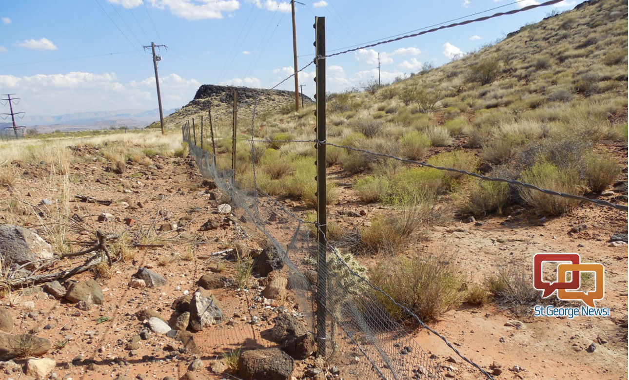
Here’s the thing. The Red Cliffs Desert Reserve already has roads going through it: Highway 18 and Red Hills Parkway. Neither of those are the end of the world. You put fences on the sides of the road and you’re done. There is still a HUGE area for tortoises to live. Look at a map of the reserve, this road would cross a tiny, tiny portion of it, and the corresponding amount of acreage could be added elsewhere.
To be clear, I’m NOT proposing further growth to the north. I don’t want it. We don’t need it. I vigorously oppose it. What I am proposing is a northern corridor that is just a road. No strip malls, no gas stations, only 3 exits: Red Hills Parkway, Green Springs, and Exit 13. Build it for east-west transportation only.
Or we can just gather up all these tortoise things, sell them off to the chinamen to make their little magic vitality potions and things (i’m sure they’ll pay a good chunk of cash for them for them–put all that money towards building more roads), develop all this newly freed up land with as many mcmansions as possible, build as many roads as possible for the developers, and if there’s any spare land at all we’ll try and get a mine or drilling operation on there as quick as possible. Only problem is lack of water, so we’ll need that powell pipeline expedited, because all these new mcmansions will need to water lots of lush greenery, and we’ll need new golf courses too, and even more water. This is the future, folks, like it or not. 😉
#1 is the best option. Pristine land has an intrinsic value that far outweighs any tax benefit from building a road to spur yet more sprawl. People can adjust to the lack of a road. If it’s too painful to drive between those two points then people don’t have to move there. It’s no skin off my back if Washington County doesn’t grow to a million people in 20 years or whatever they’re projecting.
Brian, obviously you too are very involved in this issue. What I read in your comments is basically what we hear from the commissioners and from DixieMPO. I don’t know where you get the information that “Red Cliffs Desert Reserve has never been a fixed, specific area.” Perhaps you can direct me to where that is documented because my reading of the Habitat Conservation Plan and the Incidental Take Permit, I don’t see where that is stated, nor have I ever heard that mentioned in the Habitat Conservation Advisory Committee meetings I’ve been attending regularly over the last many years. In fact, the boundaries are so specific as to have caused a large problem in the Ivins area of the reserve that backs up to the Palisades development where a lot was sold apparently incorrectly taking 30’ in the reserve. So, I would need some specific evidence to support what you’re saying. If the idea of “satellite” areas to replace what’s taken from the existing reserve/NCA is what you’re referencing, the HCP clearly addresses the need for a large area that’s not broken up. It’s not been scientifically proven that disconnected areas are helpful to tortoise habitat. That remains to be seen. The road that the county and you are purporting to be the solution to our east/west traffic movement problems will be a temporary solution. When it’s built and this county gets to 300,000-400,000, as noted in my LTE, that road will again be overrun. The legal issues it faces and the legal battles that will ensue do not make it the best choice. The further north option, clearly mentioned in several HCAC meetings years ago, may seem expensive now but by the time it’s needed the direct connection between the Ledges area and the city of Leeds might be the most reasonable for moving people away from the core of the city. Even now, the Southern Parkway seems far removed from most of us but is being used. At a recent HCAC meeting Mayor Bramall of Hurricane noted that the preferred road that would dump traffic on two already busy end points (Washington Parkway/Ex. 13 and SR 18/Bluff St) does not make sense given what he witnessed on Presidents Day weekend when traffic was bumper to bumper on I-15 near Ex. 13. Also, DixieMPO’s own studies show that the road will not solve traffic problems on St. George Blvd. and Bluff Street, in any case. The Habitat Conservation Plan clearly states no new roads and roads that bisect the reserve have been rejected repeatedly in meeting discussions. Leaders made a decision twenty some years ago; now for those who follow to come back and demand change lacks integrity. They now have their cake and want to eat it too. Leaders back then saw the growth even in the 90s and thought their decision was reasonable. Leaders now should not be surprised. What’s needed is for people to come up with a better plan.
Brian doesn’t like any type of endangered species conservation, and he’s also someone who’d benefit personally from the new route, if built.
Wash county govt leadership has proven time and time again that their priority is took look out for land development and construction interests. Everything else takes a back seat, and so many of them are in the pockets of land development interests, bought and paid for. At the end of the day cash is king and our county/city/state leaders will sell us all out any chance they get. It is what it is.
I’ll agree with you Brian, #3 seems to be the best possible option. comments, you’re right as well, local officials will sell out for money and development every time.
Very nice. I learned a lot.