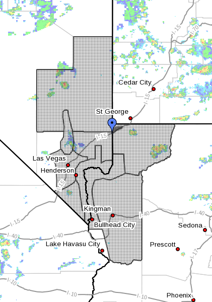
ST. GEORGE — The National Weather Service in Las Vegas has issued a flash flood watch for parts of northwest Arizona and Nevada. A series of storms are expected to develop over portions of Lincoln County in Nevada as well as southwest Utah, with heavy rains and gusty winds possible.
Affected areas
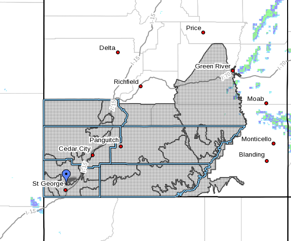
Zion National Park, South Central Utah, Glen Canyon recreation area, Lake Powell, Southern mountains and the cities of Green River, Hanksville, Beaver, Cedar City, Milford, St. George, Kanab, Escalante, Bullfrog, Loa, Panguitch and Bryce Canyon.
Timing
Scattered thunderstorms will develop in the mountains during the afternoon and will move to the southwest during the afternoon and evening. Seeing that there is a very moist airmass in place, flash flooding is possible.
Impacts
Areas at higher risk of flooding include slot canyons, normally dry washes and small streams. These areas should be avoided today and tonight. Urban areas with poor drainage may also be affected and flooding of basements in those areas is possible.
Precautionary – preparedness actions
A flash flood watch means that conditions may develop that lead to flash flooding. Flash flooding is a very dangerous situation. Monitor later forecasts and be prepared to take action should flash flood warnings be issued.
Flash flood safety
According to the Natioal Weather Service, more people die during floods than any other single severe weather hazard. The majority of these deaths occur during the night, when assessing flood danger is more difficult, often leading to people becoming trapped in vehicles. Some steps to mitigate the dangers are as follows:
- Do not drive onto a flooded roadway
- Do not drive through flowing water
- If approaching a roadway that is flooded, turn around, don’t drown
- Drive with extreme caution if roads are wet or it is raining. It is possible to lose control of a vehicle once it begins to hydroplane (when water builds up between the tires and the road surface).
If a flash flood warning is issued for your area:
- If advised to evacuate, do so immediately! Get out of areas that are subject to flooding and move to a safe area before access is cut off by flood waters. Low spots such as dips, canyons and washes are not safe places to be during flooding.
- Do not camp or park your vehicle along streams and washes, particularly during threatening conditions.
- Do not drive if necessary. If driving is absolutely necessary, do not attempt to drive over a flooded road, as the depth of the water is not always obvious, and the roadway may not be intact under the water. Never drive around a barricade, they are placed their for your protection. If your vehicle stalls, leave it immediately and move to higher ground before water sweeps you and your vehicle away.
- Do not try to walk, swim or play in flood water. You may not be able to determine if there are holes or submerged debris, or how quickly the water is flowing and you may be swept away. If water is moving swiftly, as little as 6 inches of water can knock you off your feet. There is also a danger from hazardous material polluting the water. Also remember that water is an electrical conductor — if there are power lines down, there is a possibility of electrocution.
- Always continue to monitor the situation through the National Weather Service website, NOAA Weather Radio All-Hazards or favorite local television or radio stations.