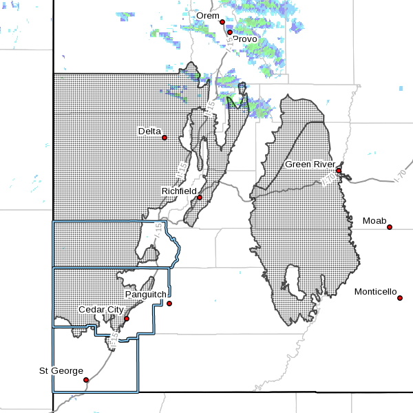
SOUTHERN UTAH – The National Weather Service has issued a wind advisory for Washington, Iron and Beaver counties effective Monday from 8:50 a.m. to 9 p.m. Winds are expected from the west-northwest at 25-35 mph, with gusts up to 50 mph.
Affected area
West central and southwest Utah, the Sanpete and Sevier valleys, Castle Country and the San Rafael Swell, including the cities of Price, Castle Dale, Emery, Green River, Hanksville, Manti, Richfield, Delta, Fillmore, Beaver, Cedar City and Milford.
Timing
Winds are expected to develop midday, with strong and gusty winds persisting through the afternoon into the early evening hours before gradually decreasing late Monday evening.
Impacts
Gusty winds will cause travel difficulties for operators of high-profile vehicles and those towing trailers. This will primarily result from crosswinds, especially along Interstate 15 from Eureka to Cedar City and state Route 10 from near Price to Fremont Junction.
Other wind sensitive operations may also be affected.
Precautionary/preparedness actions
A wind advisory means that sustained wind speeds of at least 31 mph or gusts of 45 mph are expected. Motorists in the advisory area should be prepared for sudden gusty crosswinds that can make driving difficult.
Email: [email protected]
Twitter: @STGnews