PANGUITCH — The National Weather Service in Salt Lake City has issued a wind advisory, which is in effect until 10 p.m. Sunday evening.

Affected area
Castle Country, San Rafael Swell along Interstate 70 near Fremont Junction
Winds
Northwest 25-35 mph with gusts to 50 mph
Timing
Developing midday, peaking Sunday afternoon and diminishing Sunday evening
Impacts
Gusty winds may impact travel. Crosswinds are forecast for state Route 10 from Price to Fremont Junction. The strongest winds are expected along I-70 near Fremont Junction. High-profile vehicles and those towing trailers will be especially impacted by these winds. Wind-sensitive operations may be impacted.
Precautionary/preparedness actions
A wind advisory means that sustained wind speeds of at least 31 mph or gusts of 45 mph are expected. Motorists in the advisory area should be prepared for sudden gusty crosswinds, which can make driving difficult.

Avalanche warning
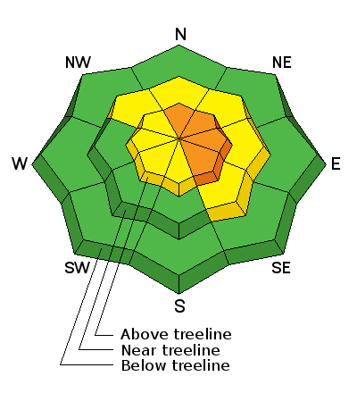
The avalanche danger in the Moab Area Mountains for Sunday is moderate in all aspects steeper than 35 degrees in upper elevation, wind-exposed terrain that have recent deposits of wind-drifted snow. With snow and wind in the forecast, the danger could rise to considerable on steep, upper elevation slopes that face North-East-South East.
Out of the wind zone, a moderate avalanche danger exists on steep northerly facing aspects where it may be possible to trigger a lingering, persistent slab avalanche.
Email: [email protected]
Twitter: @STGnews