ST. GEORGE – A “Winter Weather Advisory” for snow has been issued by the National Weather Service for seven Southern Utah counties from 6 p.m. Thursday until 6 p.m. Friday. The advisory includes the cities of Cove Fort, Koosharem, Fish Lake, Loa, Panguitch and Bryce Canyon.
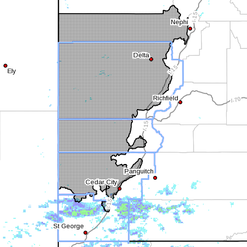
A Winter Weather Advisory has also been issued for the west-central and southwest valleys of Utah from midnight Thursday through 6 p.m. Friday, and will heavily impact the Interstate 15 corridor.
Affected area
The central and southern mountains and the west-central and southwest valleys of Utah.
Snow accumulations
The central and southern mountains of Utah are forecast to receive 7-14 inches of snow. The west-central and southwest valleys may receive 3-6 inches with the heaviest amounts along the I-15 corridor from the Interstate 70 junction south to near Cedar City.
Timing
Snow will develop Thursday afternoon and then turn heavy during the evening. Periods of heavy snow will continue Friday morning and then gradually taper off Friday afternoon.
Travel impacts
Accumulating snows beginning late Thursday will significantly impact travel through southwest and west-central Utah, especially through the I-15 corridor.
Periods of heavy snowfall will impact travel across the higher terrain of central and Southern Utah Thursday night through Friday. Those traveling during this time should be prepared for hazardous winter driving conditions and plan accordingly.
Utah Department of Transportation’s has also issued a road alert stating valley routes along the Wasatch Front southward to Nephi will be susceptible to road slush and light snow. Valley routes south of Nephi to Blackridge will see heavier road snow.
Periods of heavy road snow are possible along the entirety of I-70 and US-191, UDOT’s alert warns.
Concerns for blowing snow will remain over much of central and Southern Utah, especially higher summit routes, the alert states.
The following major roadways are identified by UDOT for road snow, slush and blowing snow during the forecast period:
- I-15, entire route
- I-70, entire route
- I-80, Dell (milepost 70) to Wyoming state line
- I-84, entire route
- US-89, entire route
- S-191, entire route
- US-189, Provo Canyon
- US-6, entire route
- US-40, entire route
For more specific information on road and highway conditions from UDOT, visit its Road Weather Alert here.
Precautionary/preparedness actions
A winter weather advisory for snow means that snow accumulations will cause primarily travel difficulties. Be prepared for snow-covered roads. Use caution while driving.
Hazardous Weather Outlook
A Hazardous Weather Outlook remains in effect through Tuesday for the western two-thirds of Utah and southwest Wyoming, including Southwest Utah, Utah’s Dixie, Zion National Park, south central Utah, Glen Canyon Recreation Area and Lake Powell.
Email: [email protected]
Twitter: @STGnews
Copyright St. George News, SaintGeorgeUtah.com LLC, 2015, all rights reserved.