TUSAYAN, Ariz. — Dry conditions over the last few days have led to increasing activity on a lightning-caused wildfire on the Tusayan Ranger District of the Kaibab National Forest.
The 1,581-acre Rock Fire is growing within established boundaries and is being managed for multiple objectives, including allowing natural fire to play its role as a disturbance factor in the ecosystem, enhancing wildlife habitat, improving forest health and reducing the potential for future high-intensity wildfires.
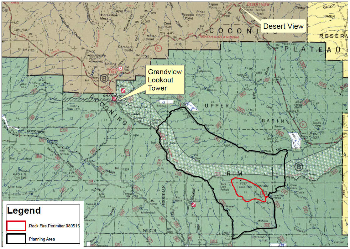
The Rock Fire, which was started July 31, is located south of the Coconino Rim about 15 miles southeast of the Town of Tusayan and is burning at a low-to-moderate level of intensity through an area dominated by ponderosa pine trees.
Fire managers plan to allow the wildfire to take its natural course within predefined boundaries in order to help restore ecological balance across the landscape.
Over the last few days, firefighters completed burn-out operations along Forest Road 316 in anticipation of the wildfire’s growth in that direction. FR 316 serves as the eastern boundary of the planning area within which the Rock Fire will be held.
Firefighters conducted burn-out operations Monday along FR 2762, which serves as the western boundary of the planning area, in advance of the fire’s natural spread. This will ensure fire managers are able to keep the Rock Fire within pre-determined perimeters over the next several days as dry conditions in the forecast indicate that the wildfire will be active.
Firefighters also continue to prepare for the fire’s likely spread by lining archaeological sites, range fences, trick tanks and any other potentially fire-sensitive resources near the fire area. This important work ensures that as the Rock Fire grows, it won’t negatively impact other values in the area.
Given dry conditions in the forecast for the next few days, the Rock Fire is expected to burn actively and produce smoke that is visible from Cameron, Tuba City, Valle and Highway 64.
There are no closures associated with the Rock Fire.
Related posts
- ‘Red flag’ conditions rising in Washington County, how to prevent wildfires
- Springs Fire pushes south, managers ready water trick tanks for wildlife
- Rock Fire grows, smoke blows northeast toward Cameron, Tuba City
Email: [email protected]
Twitter: @STGnews