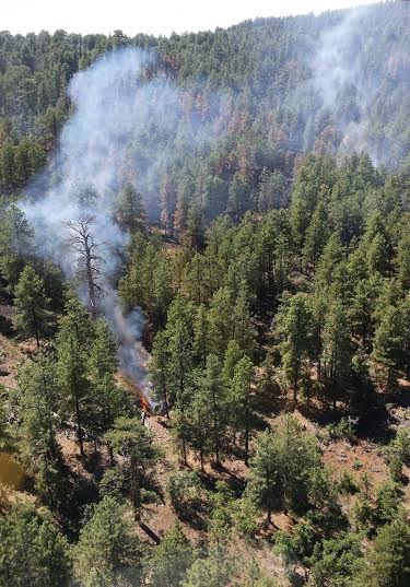
ST. GEORGE — Fire staffs continued Tuesday to manage the High Meadow Fire located approximately 55 miles southeast of St. George near Mt. Trumbull and Potato Valley on the Bureau of Land Management Arizona Strip. The lightning-caused fire started July 14. The fire is 820 acres in size and is in the Grand Canyon-Parashant National Monument portion of the BLM Arizona Strip.
The wildfire is being managed to achieve both protection and natural resource objectives.
“Private property and improvements will be protected from the fire while we use the fire to reduce downed fuel accumulation and thin the overstocked ponderosa pine stands,” said Mark Rosenthal, fire management officer for the BLM Arizona Strip District. “The positive results of this approach can be seen in the footprint of recent fires in the Mt. Trumbull area.”
Recent fire activity has increased with smoke visible from surrounding areas. Ground crews and aviation are working to minimize impacts to private property (Potato Valley) to the North. The fire is being managed by a Color Country Type 3 Incident Command Team.
There are four BLM roads closed to public traffic around the fire area, including BLM 1768, 1775, 1802 and 1803. While the Mohave County Road 5 remains open, the public is urged to use caution due to fire vehicle traffic, personnel and equipment activity and occasional smoke.
Resources on the fire include one Type 1 crew, three Type 2 crews, one wildland fire module, two Type 3 helicopters, six engines and six water tenders.
Related posts
- Additional assets arrive to support 1,387-acre Springs Fire
- High Meadow Fire continues burning, 640 acres in size
- Springs Fire grows despite recent rain, plays role in ecosystem
Email: [email protected]
Twitter: @STGnews