SOUTHERN UTAH – The National Weather Service in Salt Lake City has issued a “Winter Weather Advisory” for snow for Washington, Iron, Kane, Garfield and Beaver counties, effective from 3:42 p.m. Wednesday through 5 p.m. Thursday.
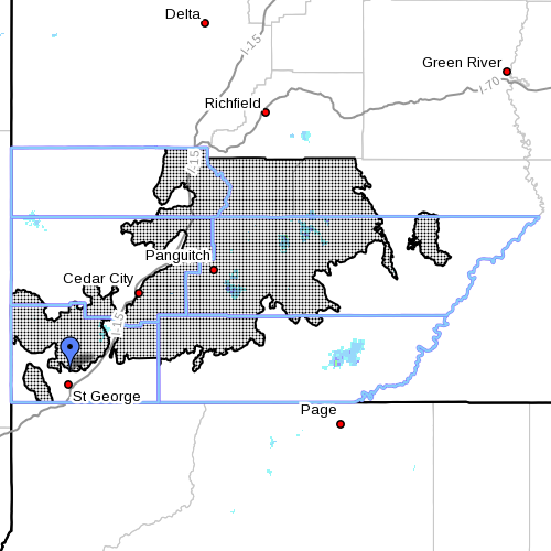
The southern mountains, including the cities of Loa, Panguitch and Bryce Canyon.
Snow accumulations
New snow accumulations of between 4-8 inches are expected overnight through Thursday. The greatest amounts can be expected across northern portions of the affected area.
Timing
Snow will be heavy at times and is expected to spread south into the affected area late Wednesday evening through Wednesday night. This snowfall may taper off for a time late Wednesday night into early Thursday morning before redeveloping during the day on Thursday.
Impacts
Winter driving conditions can be expected along all area roadways through Wednesday night, particularly along the higher passes of Interstate 15 near Beaver and on highways 20 and 89.
Precautionary/preparedness actions
A winter weather advisory for snow means snow accumulations will primarily cause travel difficulties. Motorists should be prepared for snow-covered roads and use caution while driving.
Resources
Winter road conditions from the Utah Department of Transportation can be found here or by dialing 511.
Related posts
- Weather impacts: Wind, power, roads
- News LIVE: Heavy winds blowing; STGnews Photo Gallery
- What the haze? National Weather Service explains strange haze over So. Utah
Email: [email protected]
Twitter: @STGnews
Copyright St. George News, SaintGeorgeUtah.com LLC, 2015, all rights reserved.