
SOUTHERN UTAH — Snow is falling in Southern Utah, roads are wet and slick and visibility is poor in some areas, including Iron County. Motorist caution is advised, with Utah Department of Transportation issuing an emergency alert and travel alerts due to hazardous road conditions Sunday.
The National Weather Service has also issued warning, upgrading its earlier “Winter Storm Watch” to a “Winter Storm Warning” for heavy snow in the central and southern mountain regions of Utah, in effect until 8 a.m. Tuesday.
Affected areas
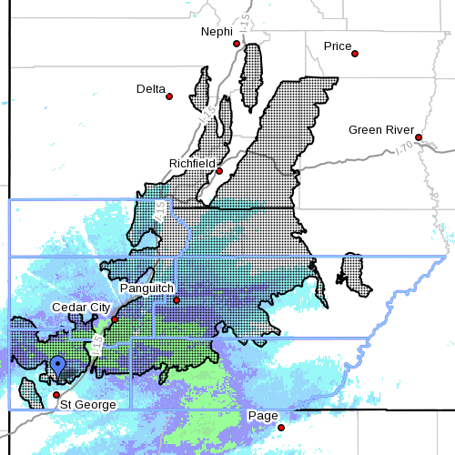
Washington, Kane, Iron, Garfield and Beaver counties are subject to the weather service warning, including the cities of Fish Lake, Cove Fort, Koosharem, Panguitch, Loa, and Bryce Canyon.
Snow accumulations
Snow is expected to accumulate between 1-2 feet within the affected areas. Higher amounts of snow are possible on eastern and southern facing slopes.
Travel advisories and road conditions
According to UDOT, all semi trucks are prohibited on state Route 14 due to hazardous winter road conditions. The restriction is expected to remain in place through the current winter storm over the area.
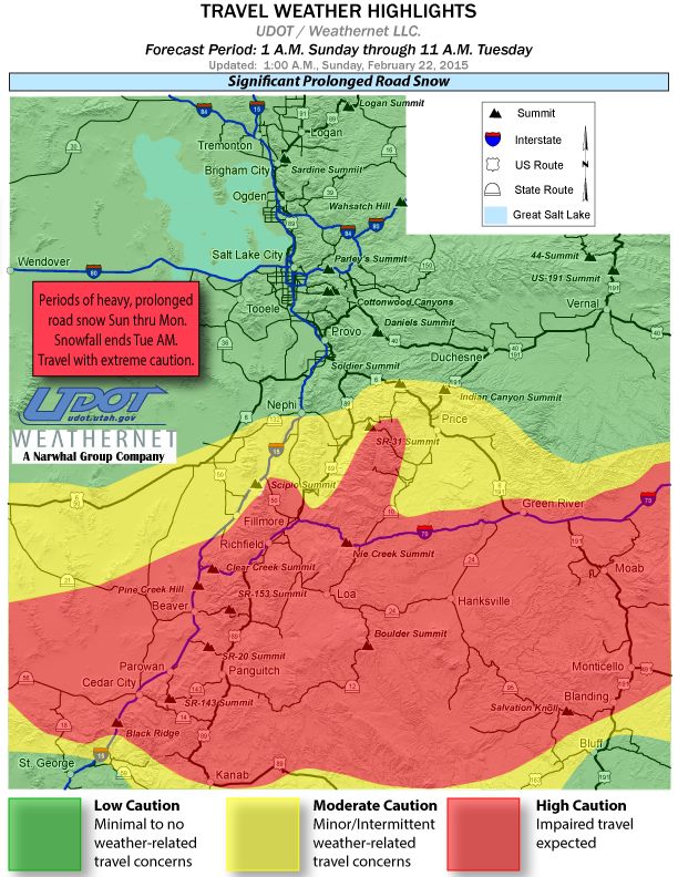
Periods of slush and snow accumulations along Interstate 15 between Leeds and Nephi are expected through 9 a.m Tuesday. Snow could become especially heavy at times on Sunday night between Scipio and Black Ridge.
Snow is also expected to be quite heavy along Interstate 70 between Sevier and Salina, Ivie Creek Summit, and between Fremont Junction and the Colorado border. Slush on the roads is also to be expected.
Driving conditions in the affected areas may become hazardous, so drivers are encouraged to keep a survival kit in their vehicles in case an emergency should arise.
Resources
- For route-specific information on Utah’s roads and highways click here

Related posts
- Search and Rescue saves the day for man stranded near Kolob Reservoir
- Winter Storm Warning; what to do if you’re stuck in snow, safety kit list
- Police Department offers winter weather driving tips
- Warm winter can wreak havoc on trees, plants, shrubs; STGnews Videocast
- Parowan residents not all happy about new snow removal ordinance
Email: [email protected]
Twitter: @STGnews
Copyright St. George News, SaintGeorgeUtah.com LLC, 2015, all rights reserved.