WASHINGTON COUNTY – The National Weather Service has issued a “Fire Weather Watch” for Washington County. The alert is in effect from 11 a.m., Sunday through 10 p.m., Monday, for wind and relative low humidity.
Affected area
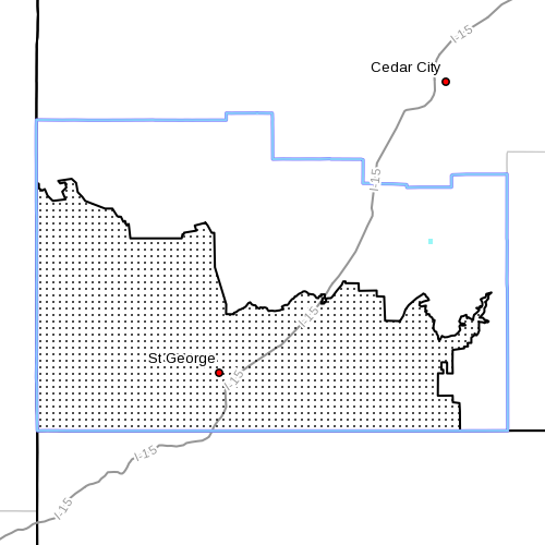
Fire Weather Zones 497 – Mojave Desert (see map insert).
Winds
South to southwest winds 20-30 mph with gusts up to 45 mph are expected to develop by midday Sunday and continue through the evening. Winds should decrease below critical values Sunday night and Monday morning before increasing again Monday afternoon and evening. Winds will diminish again Monday evening.
Relative humidity
As low as 6 percent Sunday and Monday afternoon and evening. Nighttime relative humidity recovery will be poor.
Impacts
The combination of strong winds and low relative humidity is expected to create hazardous fire weather conditions where fuels are critically dry.
Precautionary, preparedness actions
A Fire Weather Watch means that there is a potential for critical fire weather conditions. Continue to monitor for the latest forecasts and for possible red flag warnings.
Related posts
- Fire weather watch for Mesquite area
- Red Flag Alert: Grand Staircase, Washington, Kane Counties
- Summer fire safety; prevention, awareness benefit communities
- Gunlock hopes to unlock funding for new firehouse
- Officials urge residents to prepare for upcoming fire season
- Multiple agencies take part in wildland-urban interface firefighting training
- Fire mitigation efforts save homes
- Human Attention Means Fire Prevention: Tips to Stop Human-Caused Fires
Email: [email protected]
Twitter: @STGnews
Copyright St. George News, SaintGeorgeUtah.com LLC, 2014, all rights reserved.
Service